Big Slide Lake

So this past weekend Steve, the pups and I went on our first backpacking trip of the season. We usually get started with our backpacking season earlier in the year, but this spring we went on a trip to Nicaragua and then we had the moms in town. Needless to say we were pretty pumped to be taking the weekend off to head up to the Bull of the Woods Wilderness. I think this is only the second hike I have ever done in Bull of the Woods, so it was nice to explore it a bit more. We took the Dickey Creek trail all the way up to Big Slide Lake where we camped for the night. Quick Stats Distance: 12 miles Time: 4 hours each way Difficulty: difficult, pretty steep in parts with loose rock, many logs to climb over, and a fun creek crossing Permit: Yes, NW Wilderness Pass, get it ahead of time because there isn’t … Continue reading

A Weekend In Bend

So you’re planning a trip to Bend, huh? Maybe you’re coming for the killer mountain biking,  the brewery scene, or maybe just to get some more Vitamin D in your life. Steve and I have been living in Bend for … Continue reading

McKenzie River Trail & Clear Lake

The McKenzie River Trail is a super popular trail in the Cascade Range. It’s one that I’ve always skipped because I love alpine hiking. After a recommendation from one of my coworkers I figured it was about time to give … Continue reading

Finding the Beauty…

If you follow my blog regularly you’d think that I’m always going on perfect hikes with perfect weather and going on amazing trips with perfectly planned itineraries, but that is not the case. Often times we will head out for … Continue reading

Deschutes River Trail: Lava Island Falls to Aspen

Quick Stats Distance: approx. 4 miles Time: 2 hours (at a leisurely pace) Difficulty: Easy Dog Friendly: Yes, Off-leash in the wintertime Permits: Yes, Northwest Forest Pass Pros: Beautiful, easy trail minutes from town, option to make hike as easy … Continue reading

Vista Butte Snowshoe

This winter season hasn’t necessarily been the best for outdoor pursuits, but Steve and I have managed to go snowshoeing at Vista Butte Sno-Park twice this season. It’s literally a twenty minute drive, at most, from our house, it’s relatively … Continue reading

Tumalo Falls to Happy Valley

Quick Stats Distance: 8 miles roundtrip (can also make a loop out of it if you want) Time: 3 1/2-4 hours Difficulty: Easy to moderate Season: June to October Permit: Northwest Forest Pass Dog Friendly: Yes. Off-leash fun for most … Continue reading

Big Slide Lake

Big-slide-lake-mt.jefferson-view

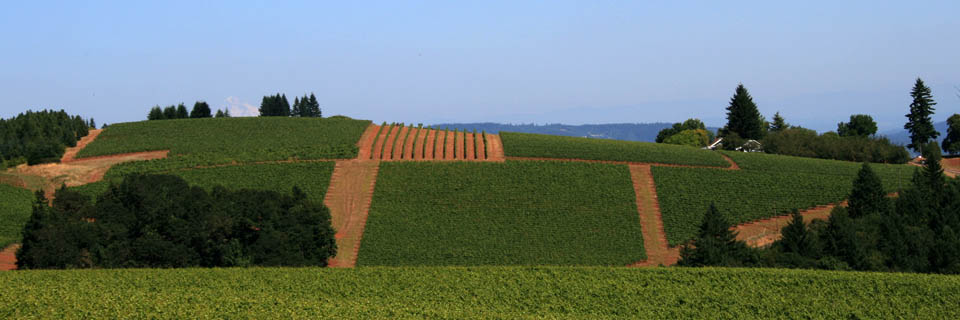
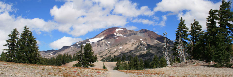
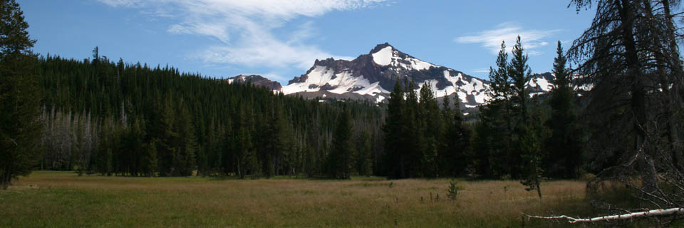
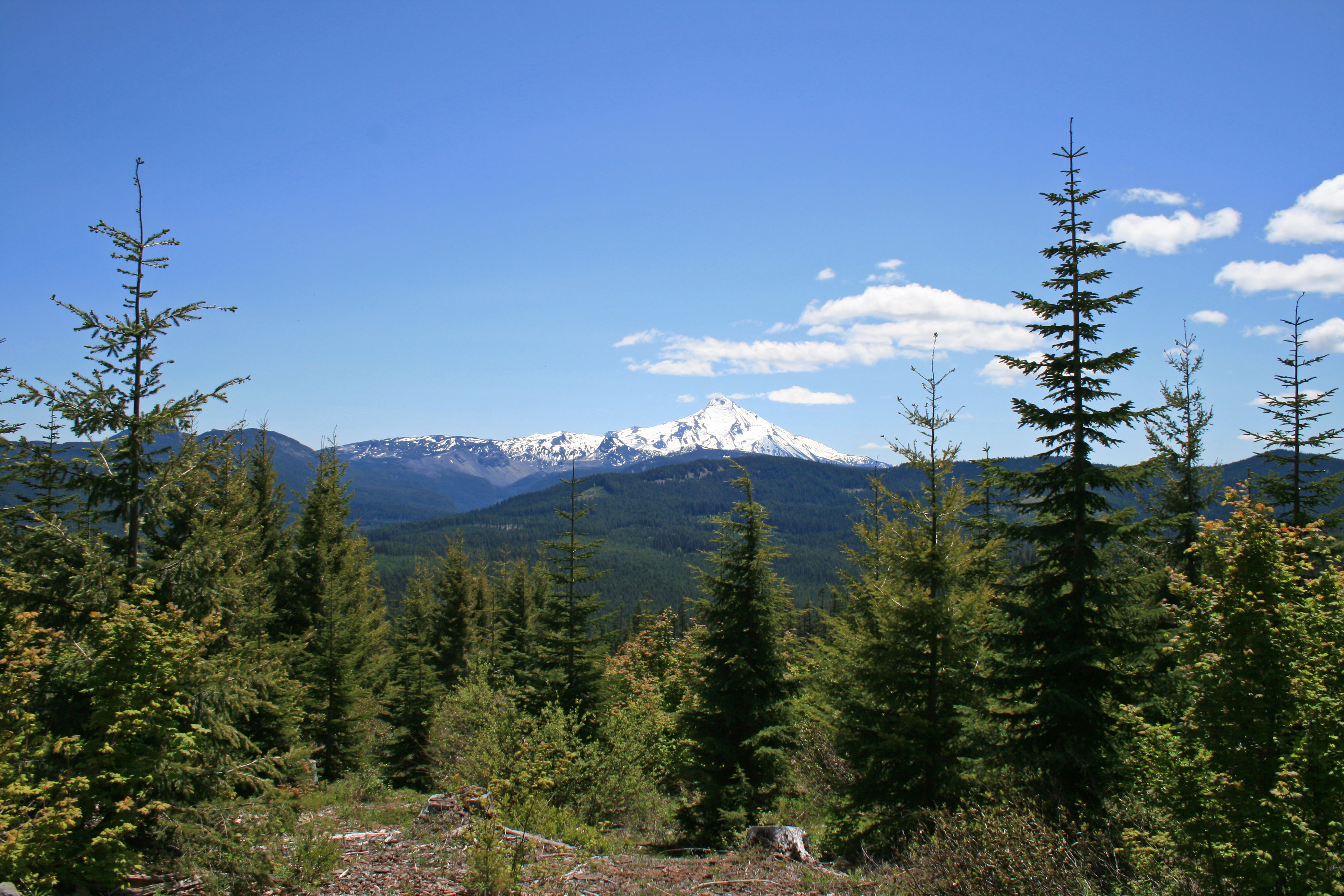
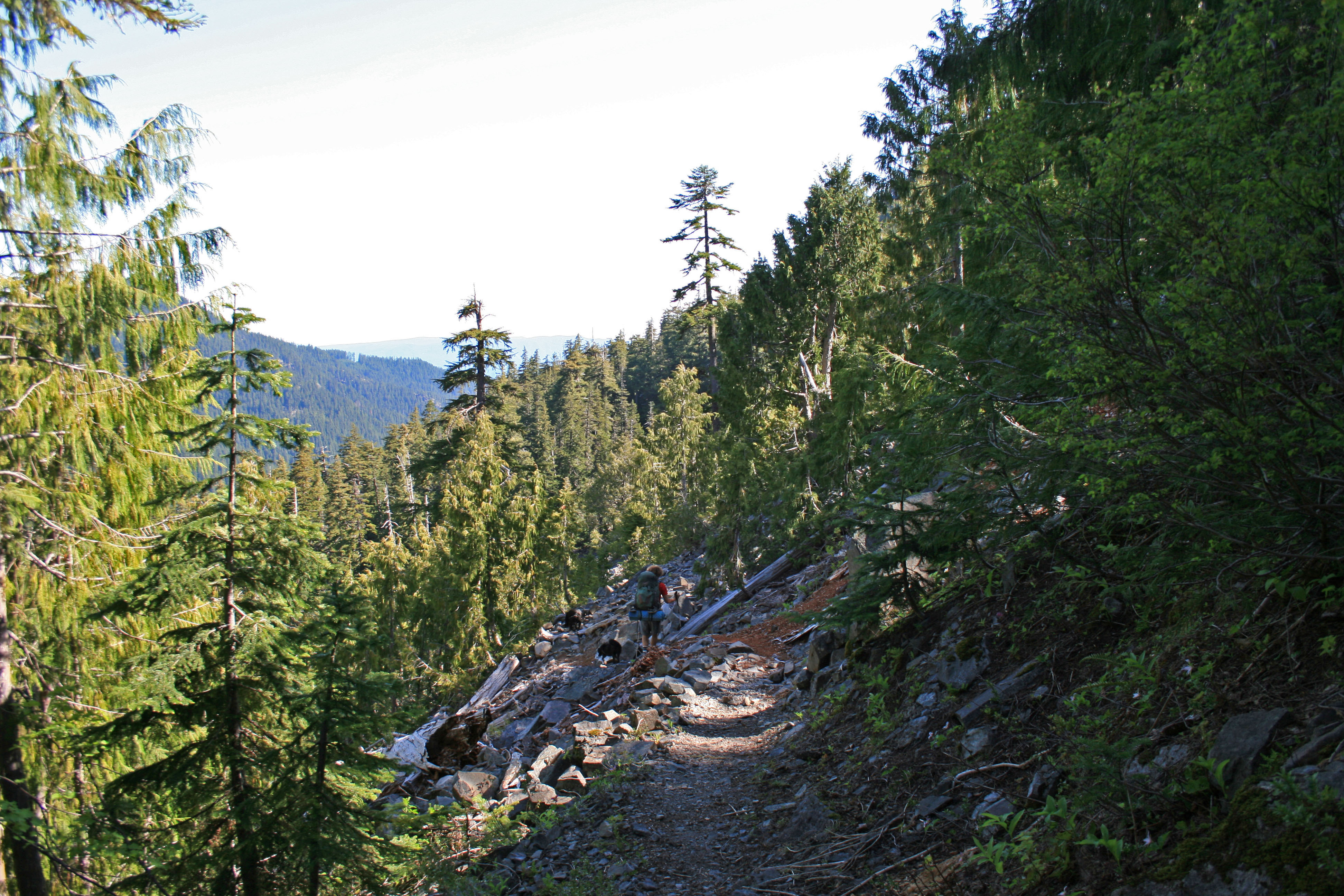
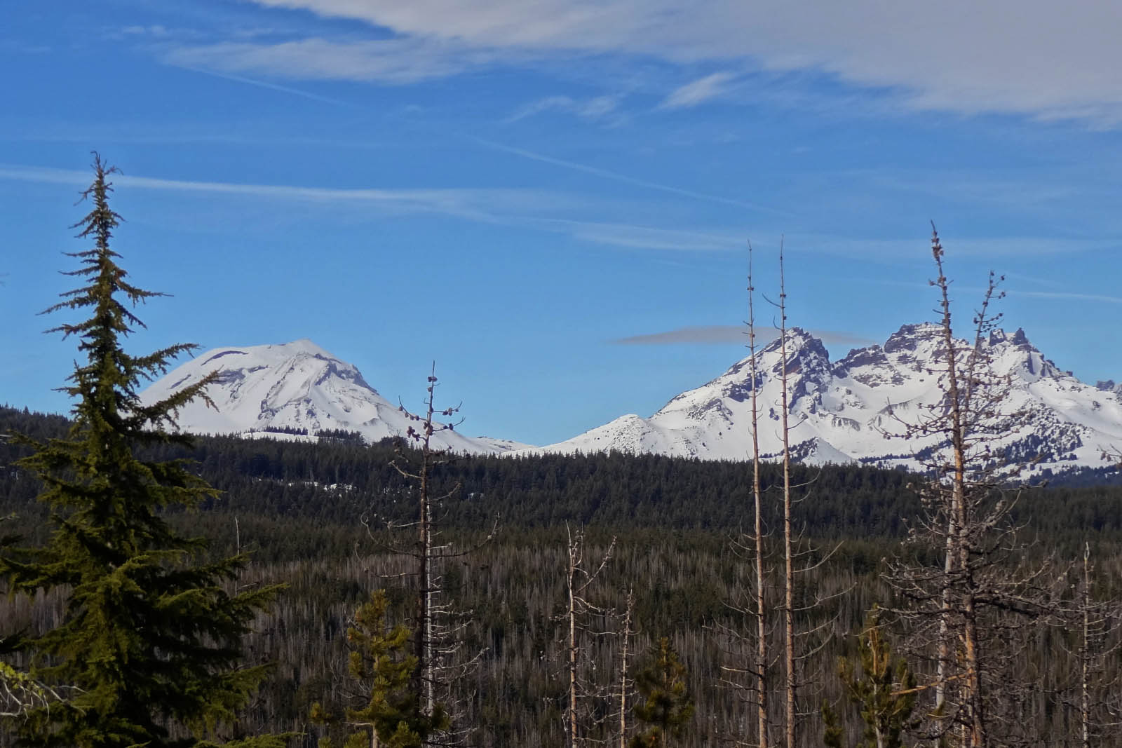
View from the forest service road…not too bad

So this past weekend Steve, the pups and I went on our first backpacking trip of the season. We usually get started with our backpacking season earlier in the year, but this spring we went on a trip to Nicaragua and then we had the moms in town. Needless to say we were pretty pumped to be taking the weekend off to head up to the Bull of the Woods Wilderness. I think this is only the second hike I have ever done in Bull of the Woods, so it was nice to explore it a bit more. We took the Dickey Creek trail all the way up to Big Slide Lake where we camped for the night.

Quick Stats

Distance: 12 miles

Time: 4 hours each way

Difficulty: difficult, pretty steep in parts with loose rock, many logs to climb over, and a fun creek crossing

Permit: Yes, NW Wilderness Pass, get it ahead of time because there isn’t a pay station at the trailhead

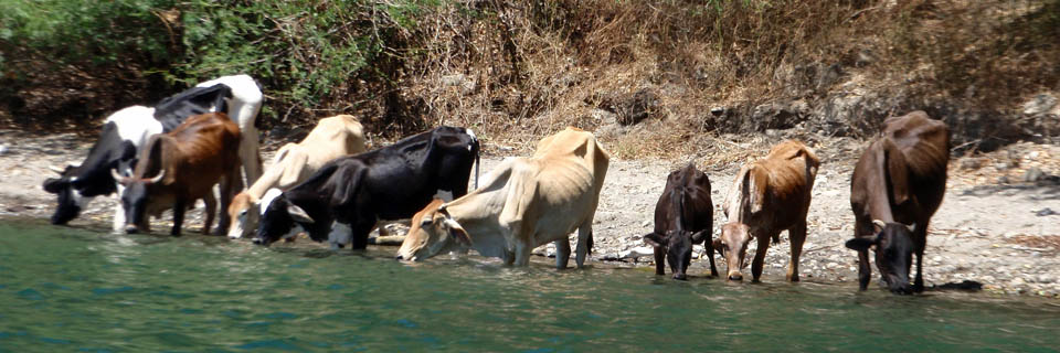
Dog friendly: Yes, plenty of shade and creeks for cooling off in…and of course there is the lake too

Pros: Beautiful mossy forest, pretty lake and creek, trail wasn’t busy, wildflowers and rhododendrons,

Cons: steep and loose trail in spots, all uphill on day one and all downhill on day two, crowded weekend camping at the lake, people didn’t bury their poo

big-slide-lake-2

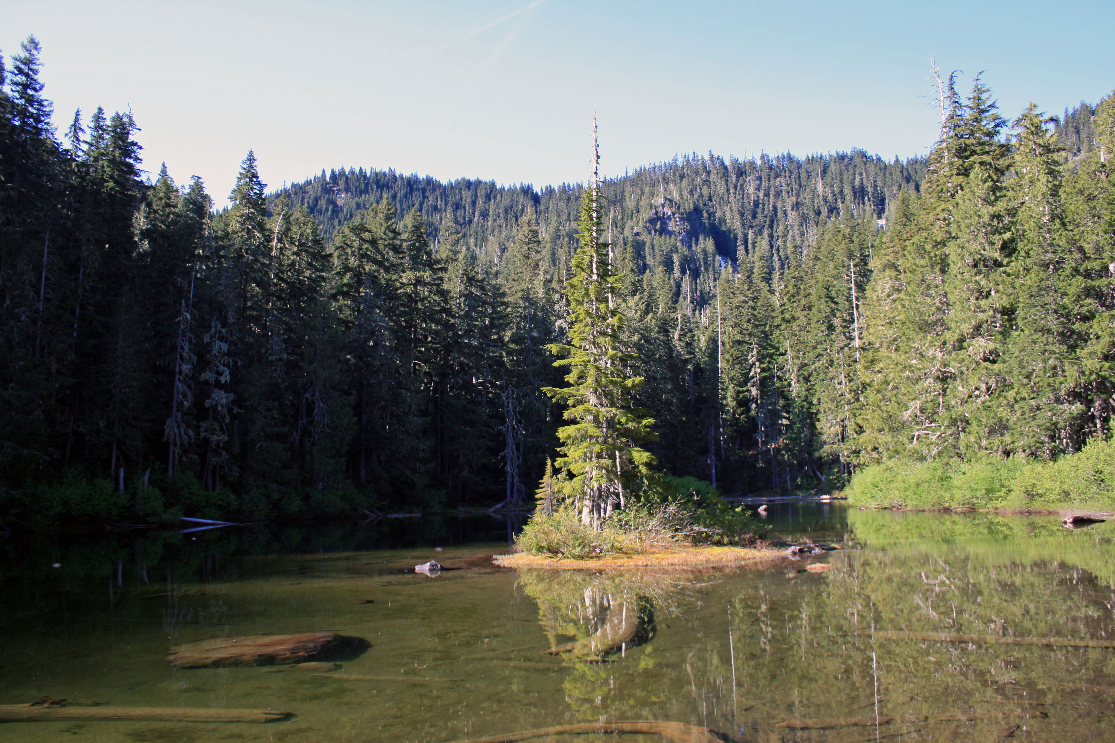
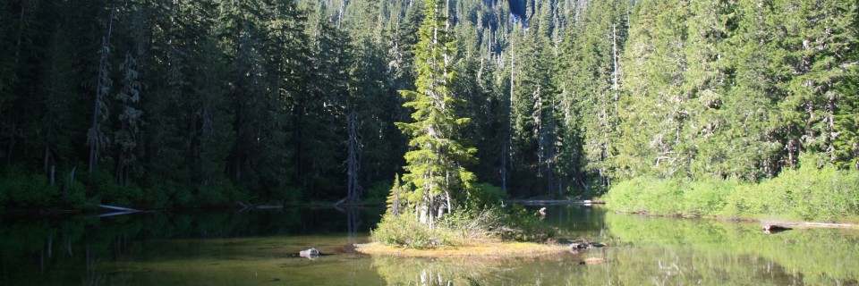
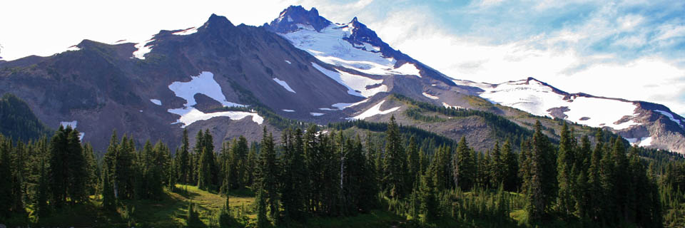
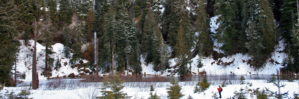
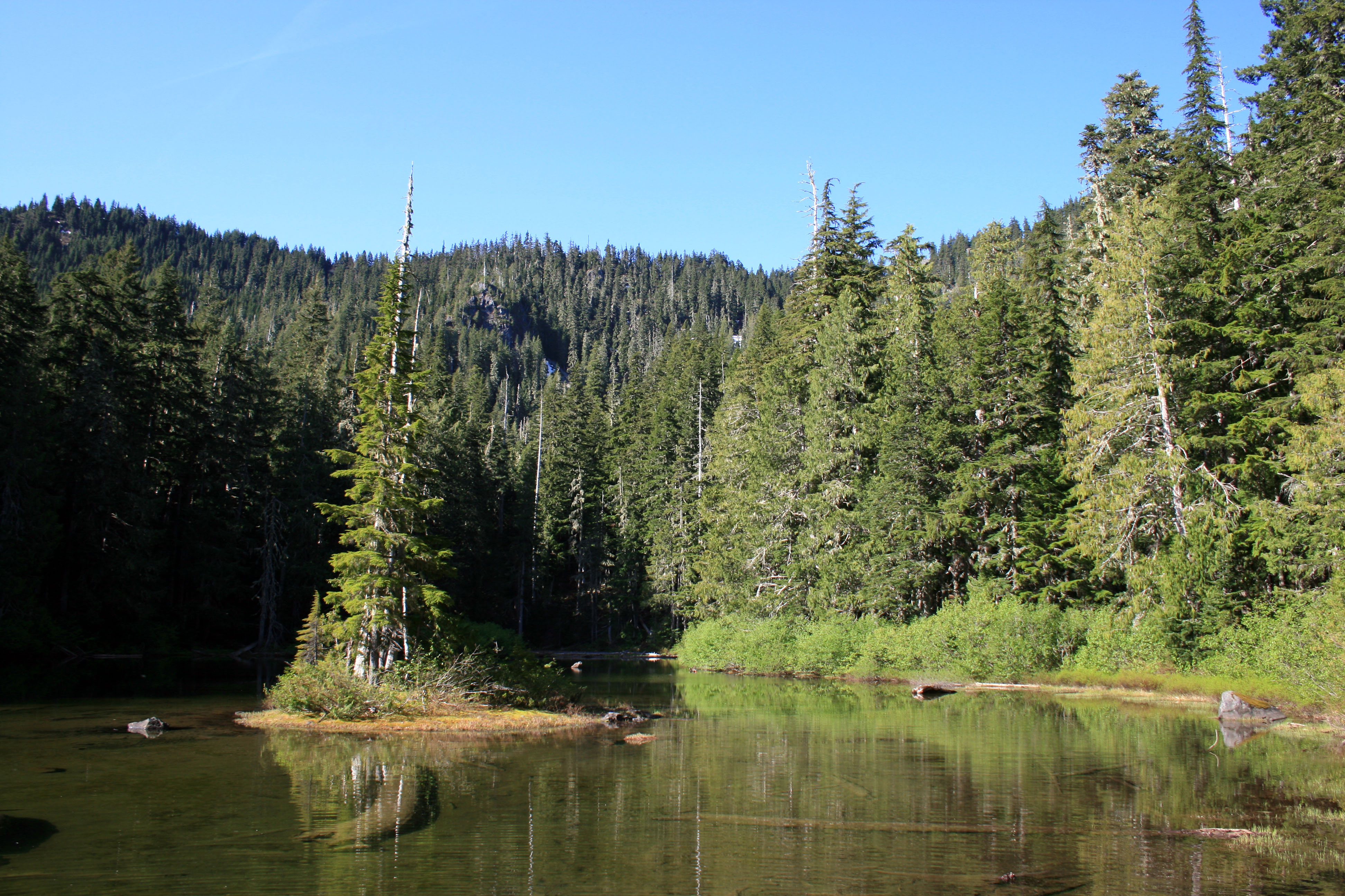
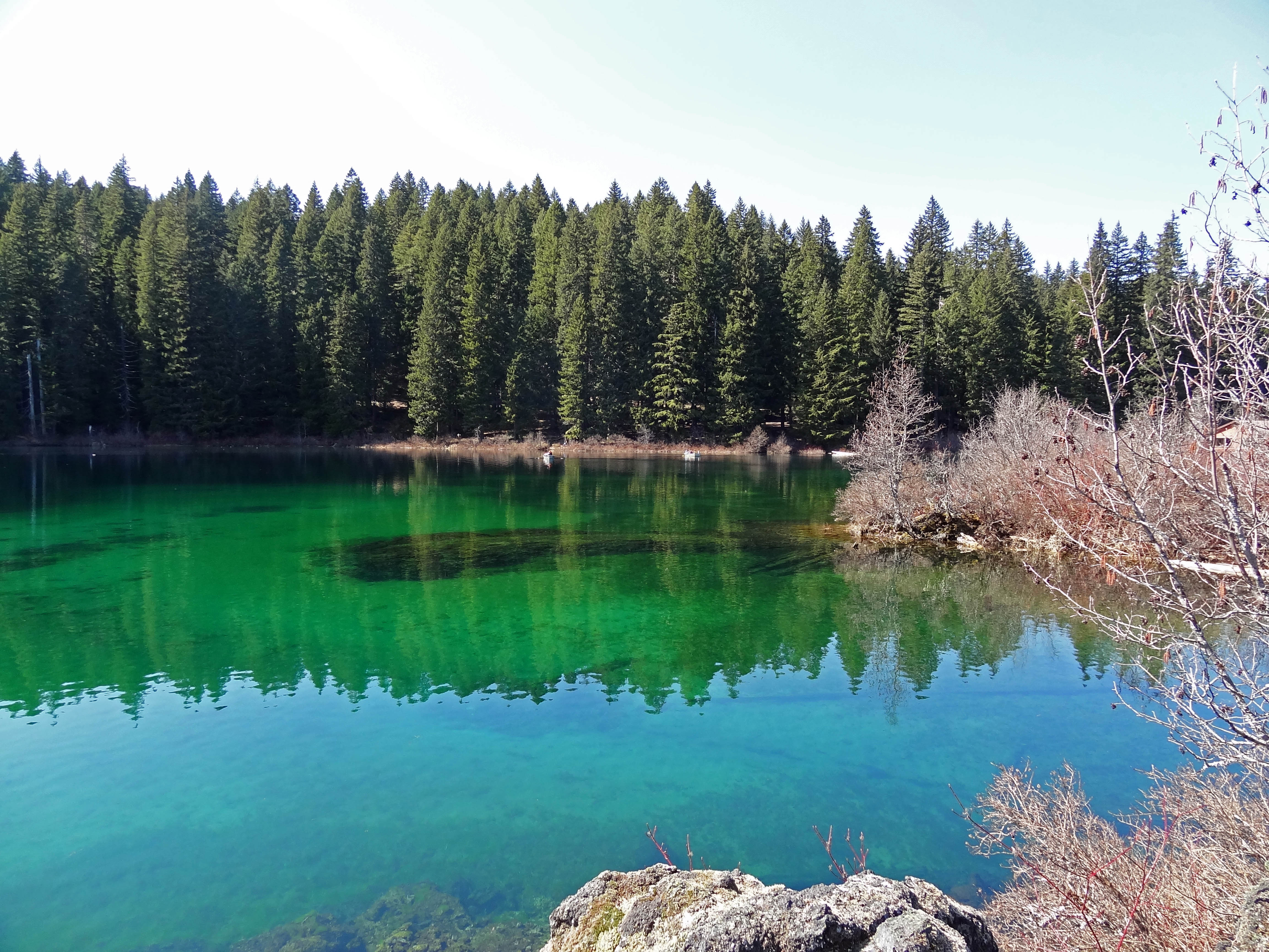
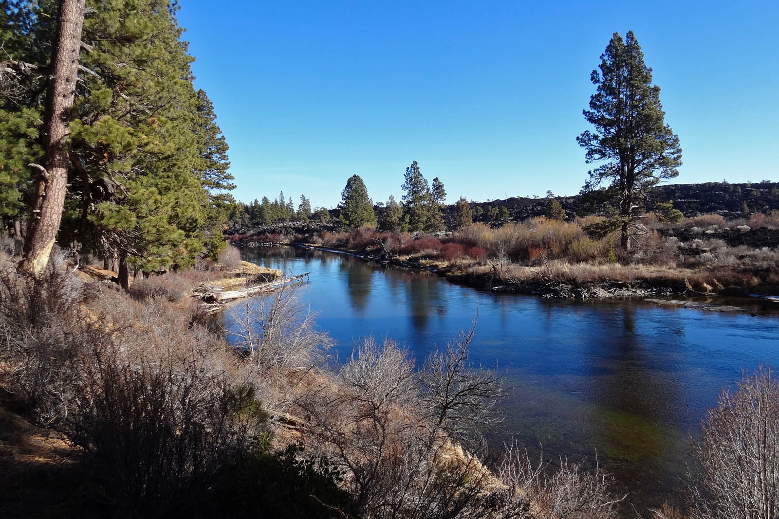
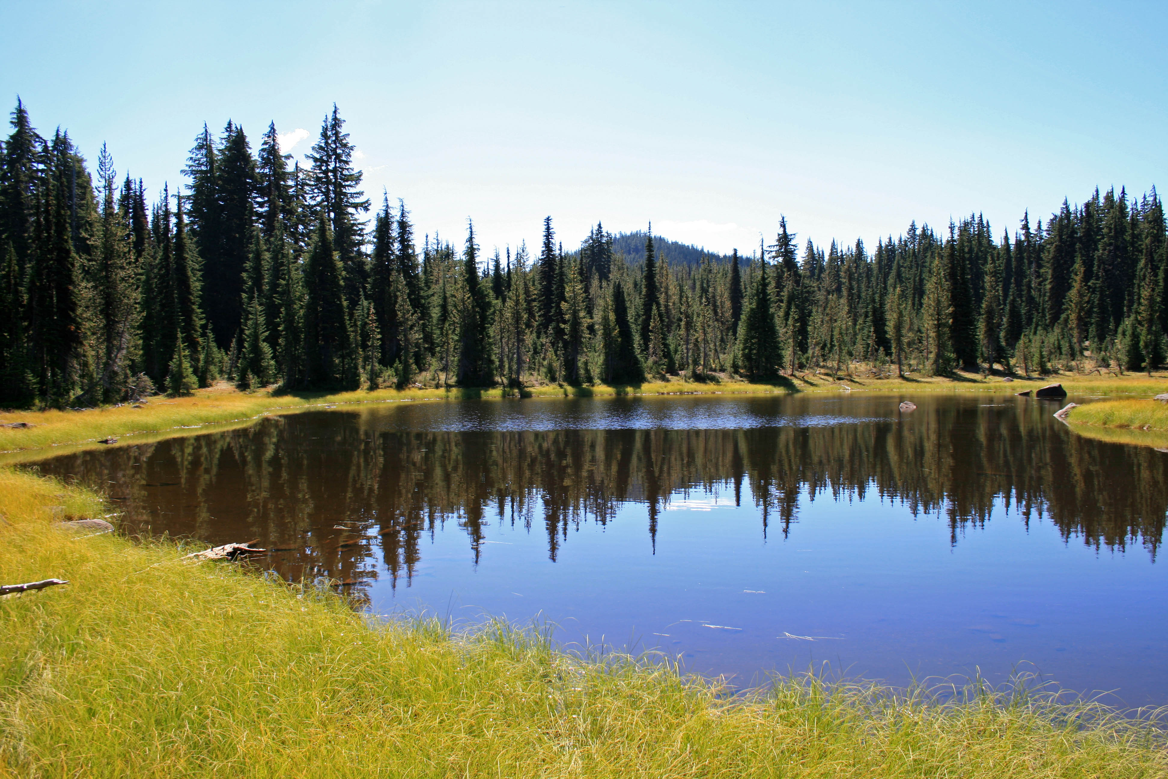
Our destination for the night…wasn’t quite warm enough for swimming.

It took us about three hours to drive to the Dickey Creek Trailhead from Bend. Our google directions had us take about an hours worth of gravel roads, which we didn’t really need to do, but it added to the sense of adventure, so why not? It took us the same amount of time to get home when we took mostly paved roads.

Big-Slide-lake-mossy-trail

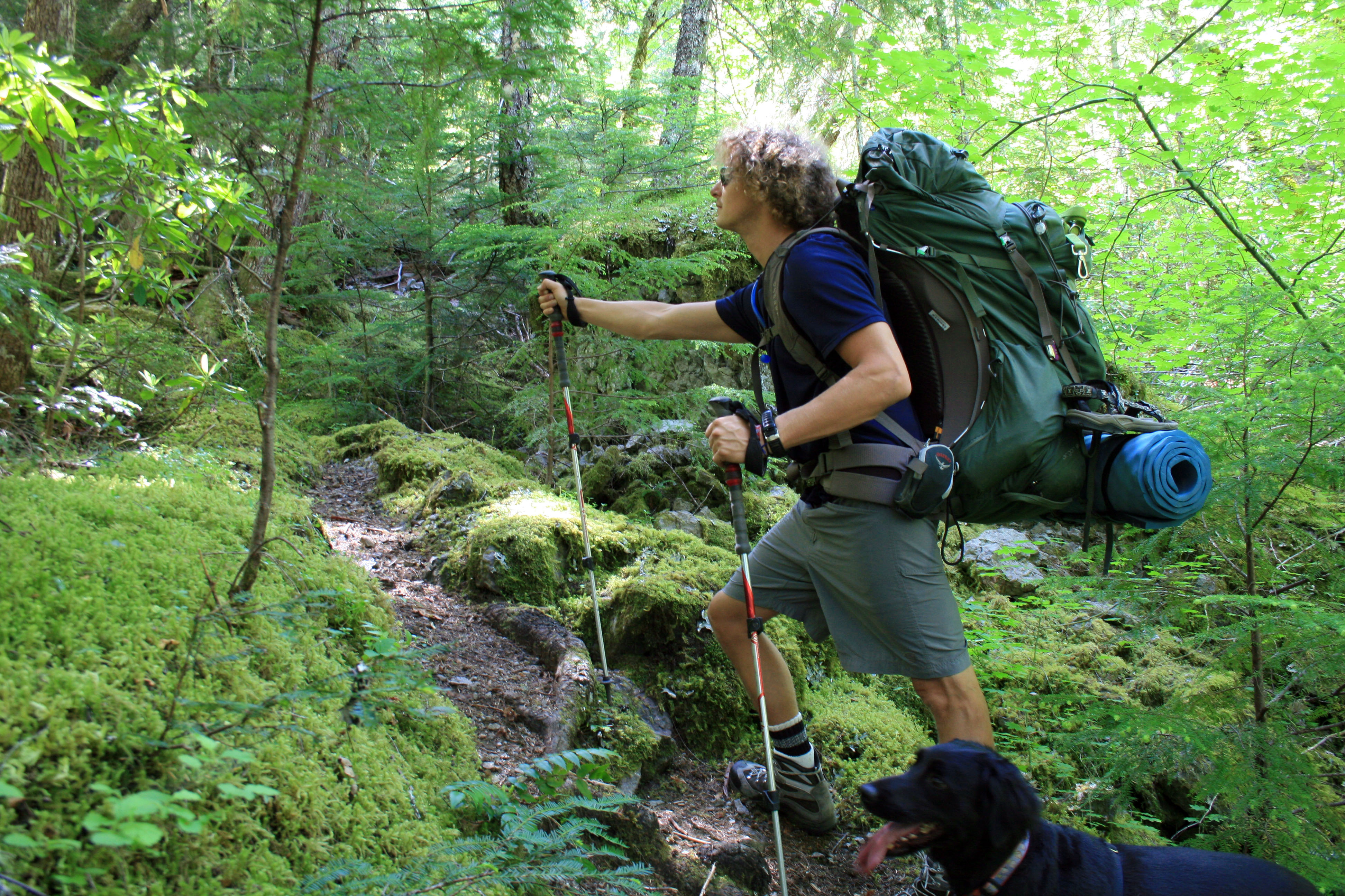
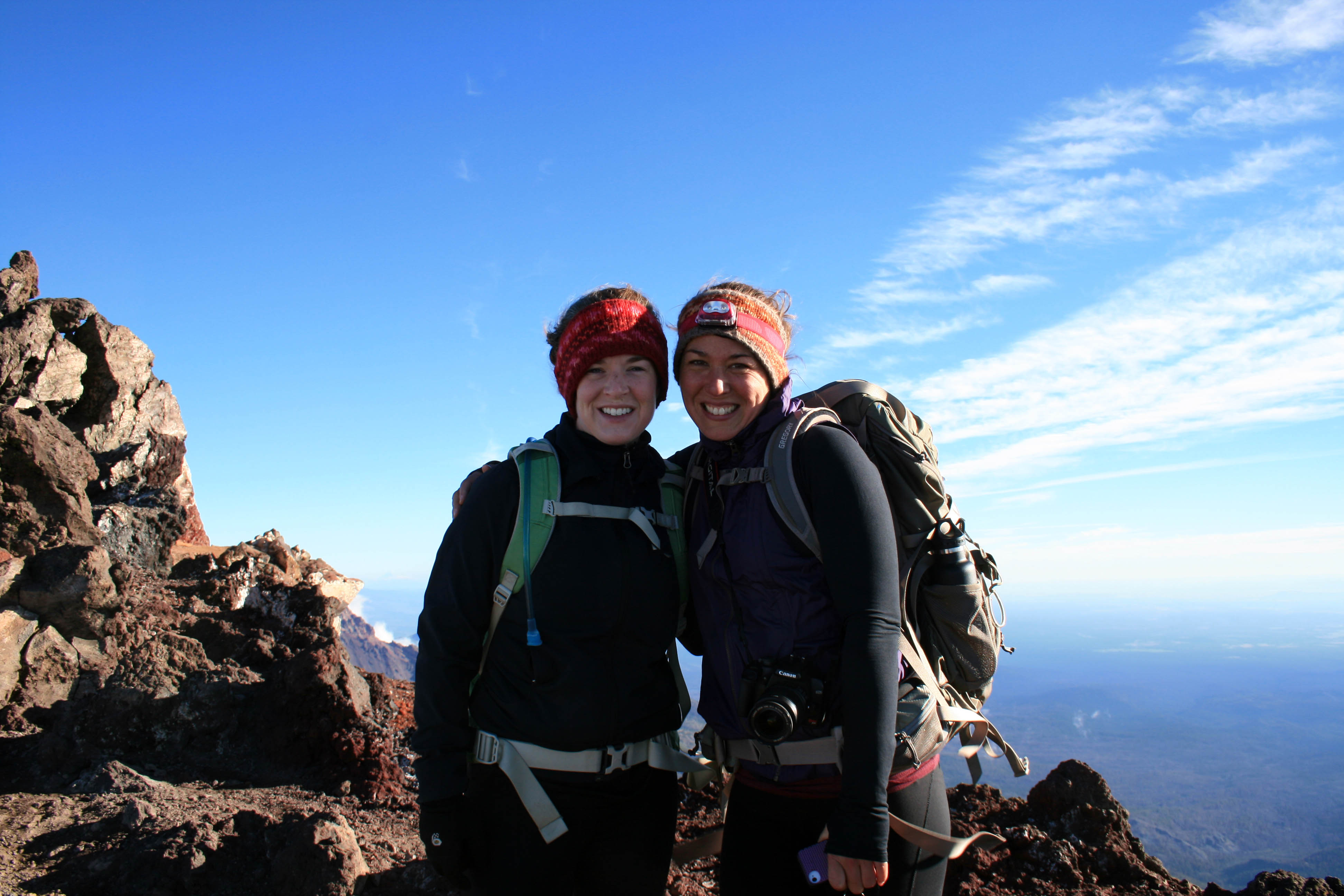
Steve…trying to look outdoorsy..or contemplative… I’m not sure

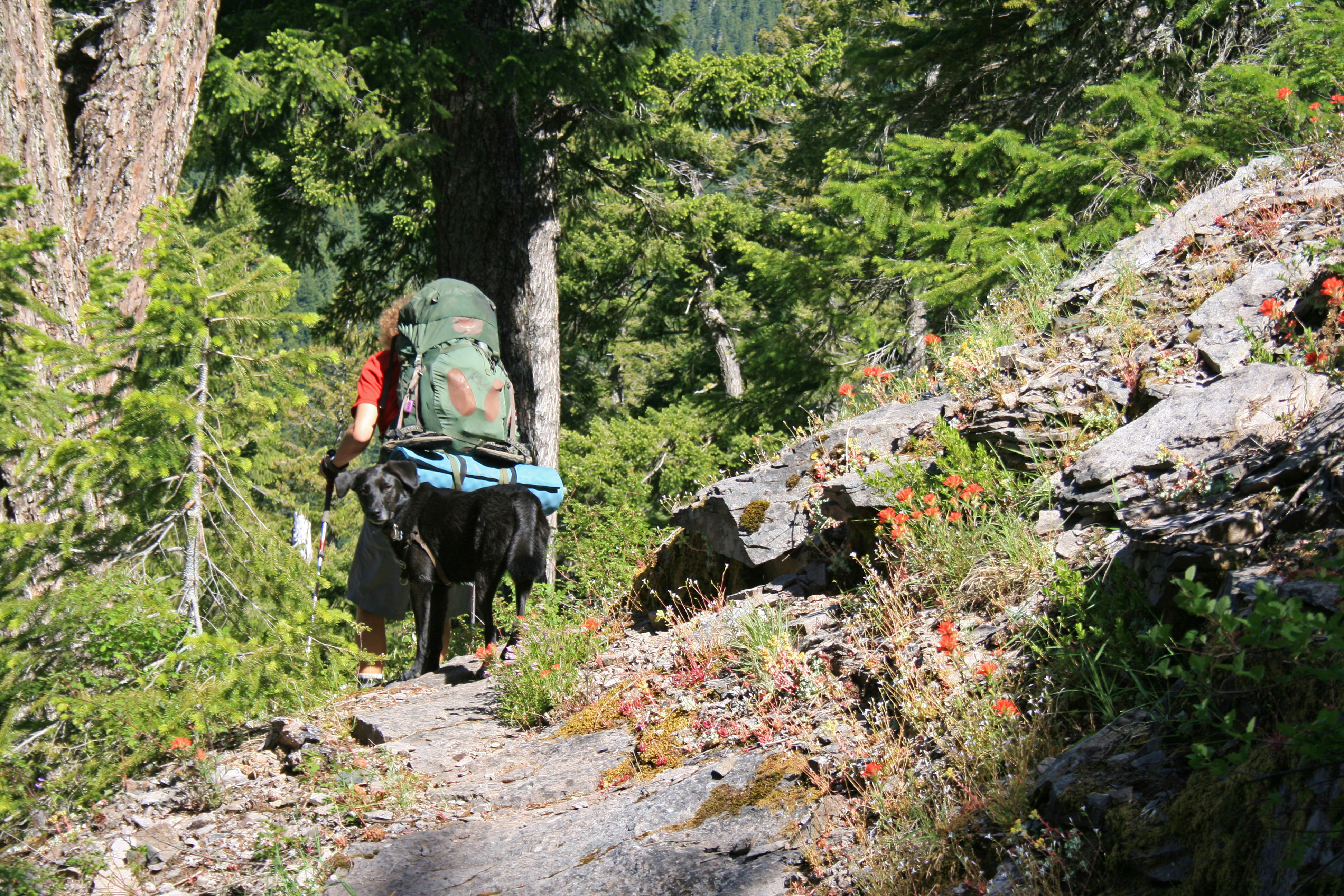
The Dickey Creek trail begins harmlessly enough as it follows an old forest road, but don’t be fooled. You will have multiple opportunities to fall on your ass as the trail steeply descends into the valley. Have fun with it! I didn’t! It took me 20 minutes to get down the first steep section because I was being stubborn and didn’t want to get out my trekking poles…. I ended up borrowing Steve’s for this section. Advice: Pack your poles and use them. Other people camping at the lake commented multiple times that they wish they had brought theirs.

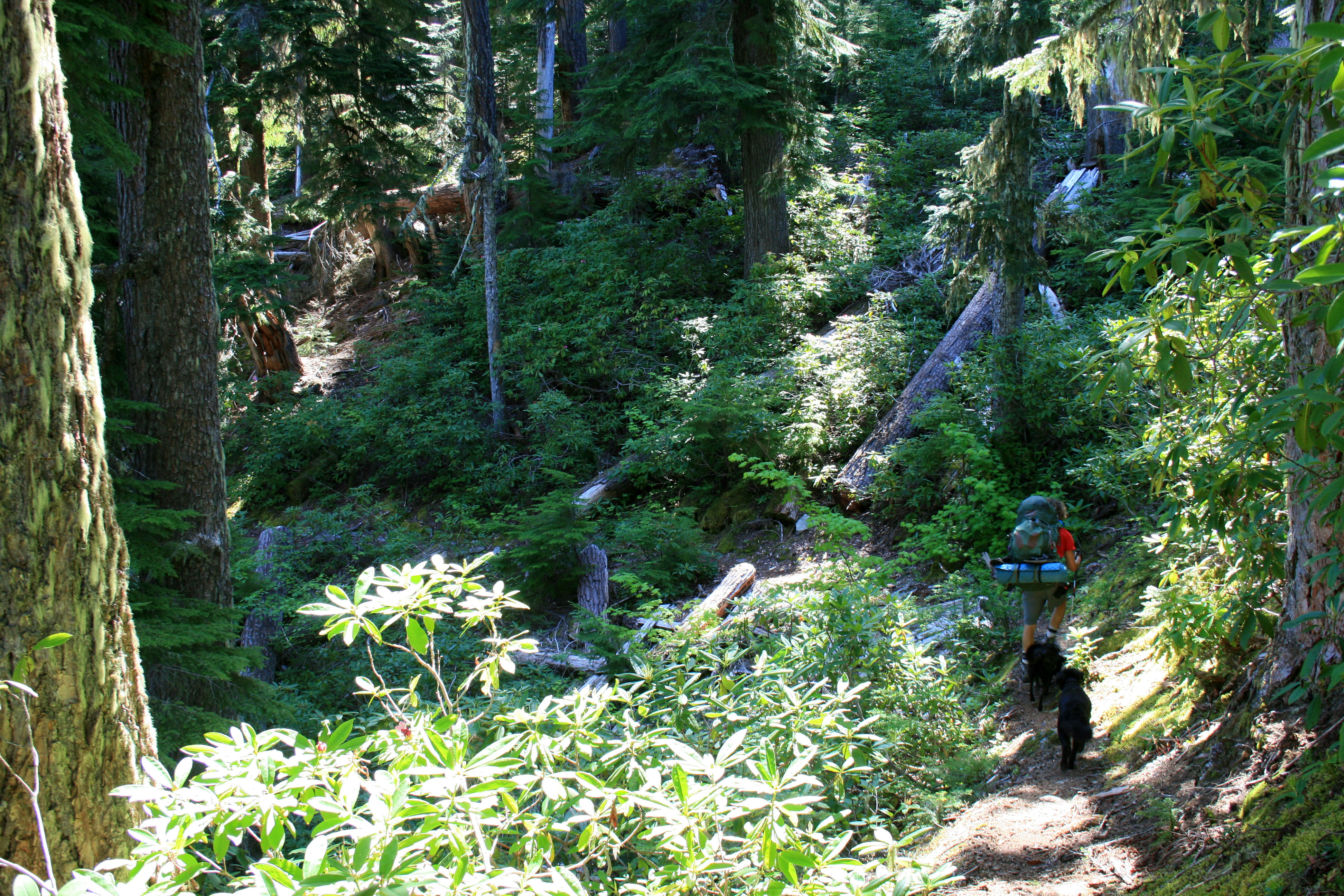
Thankfully, after the trail makes its initial descent into the valley via slippery slopes and some massive steps it becomes a beautiful hike through moss covered forest as it gently meanders by massive trees and over a few logs.

Big-slide-lake-forest

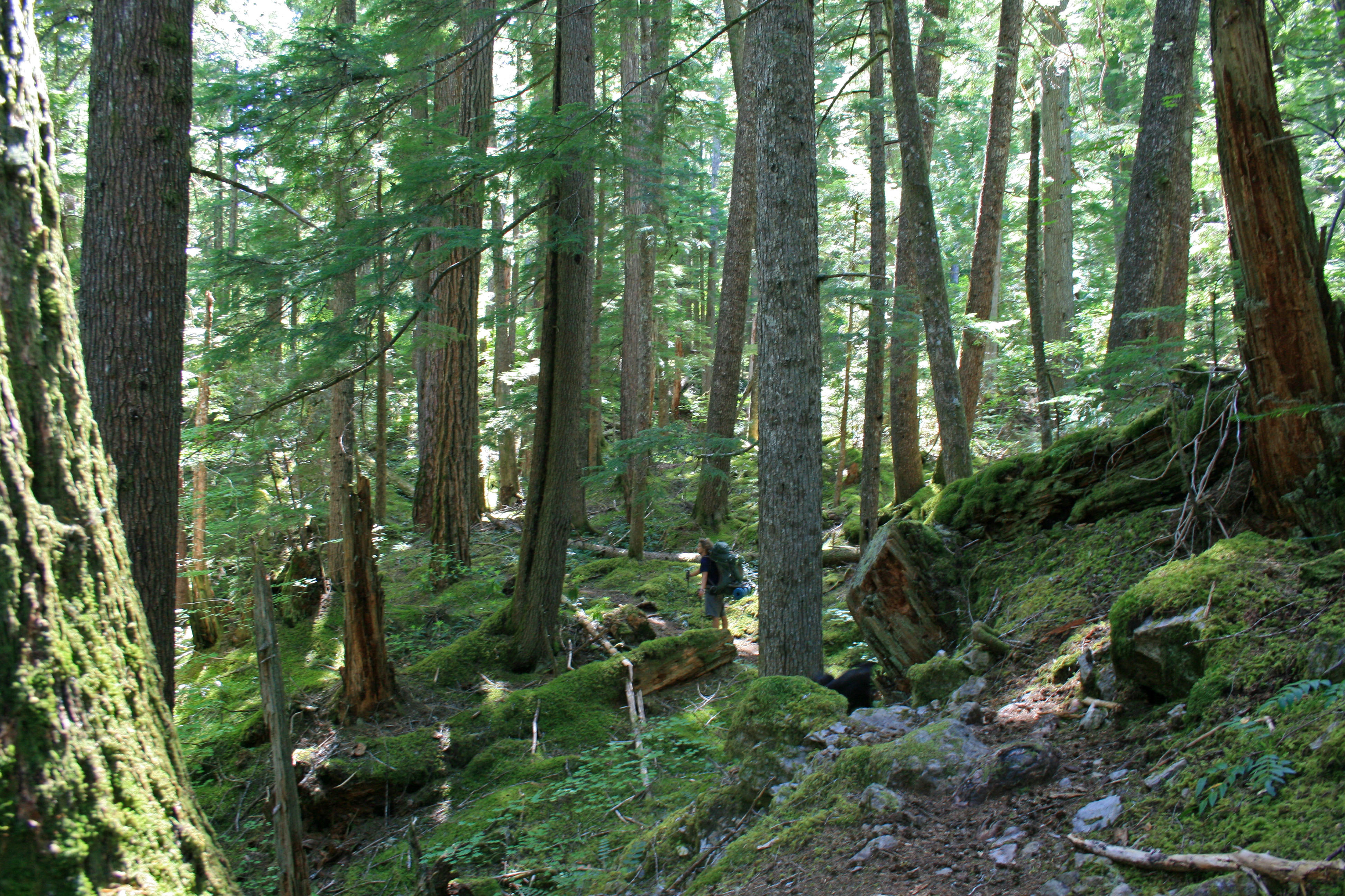
Where’s Waldo? I mean Steve?

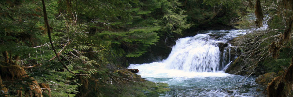
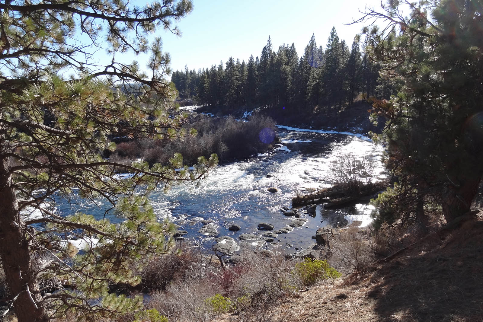
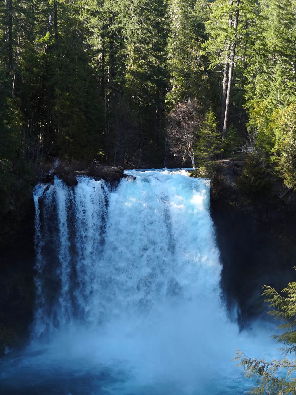
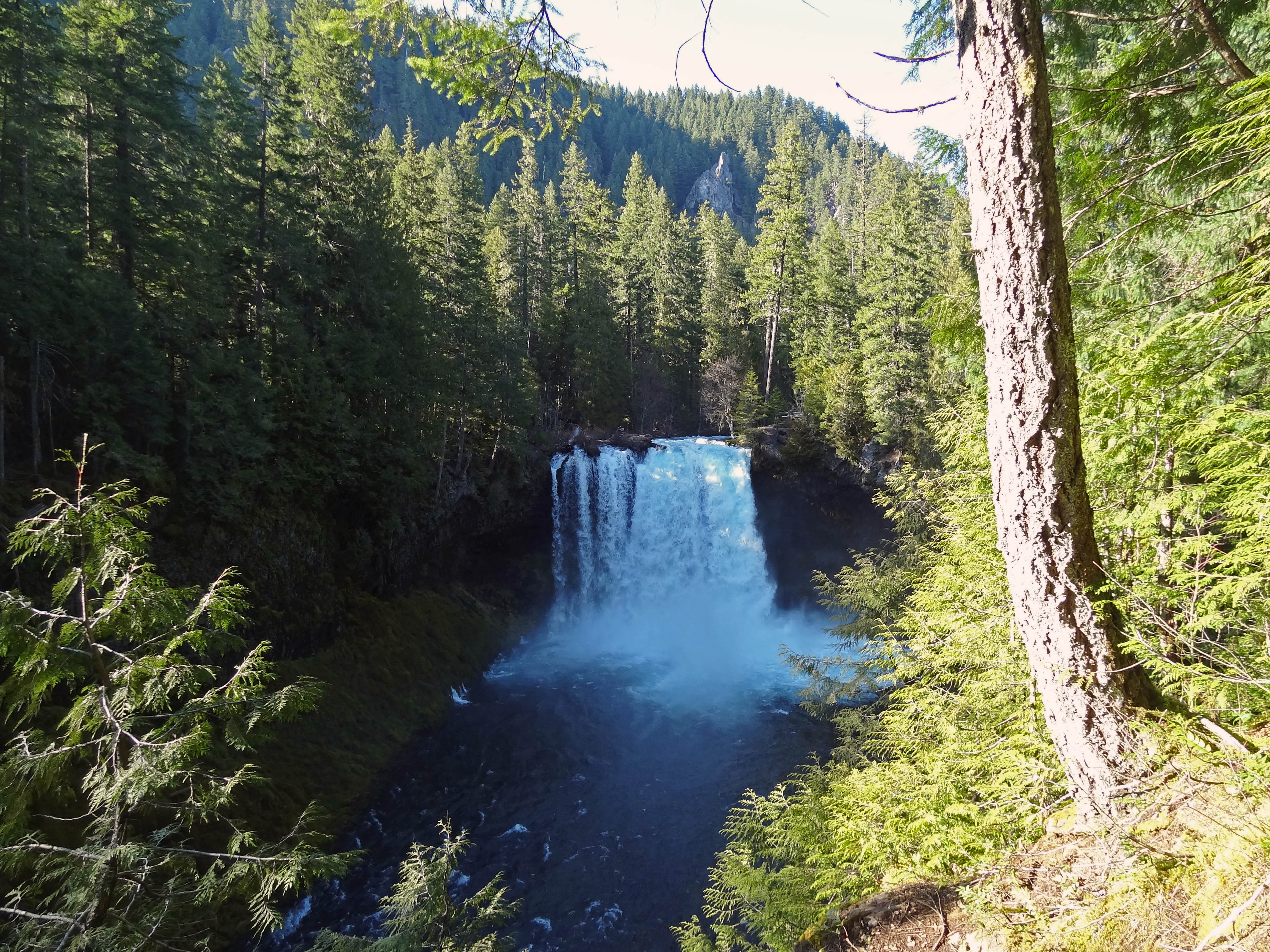
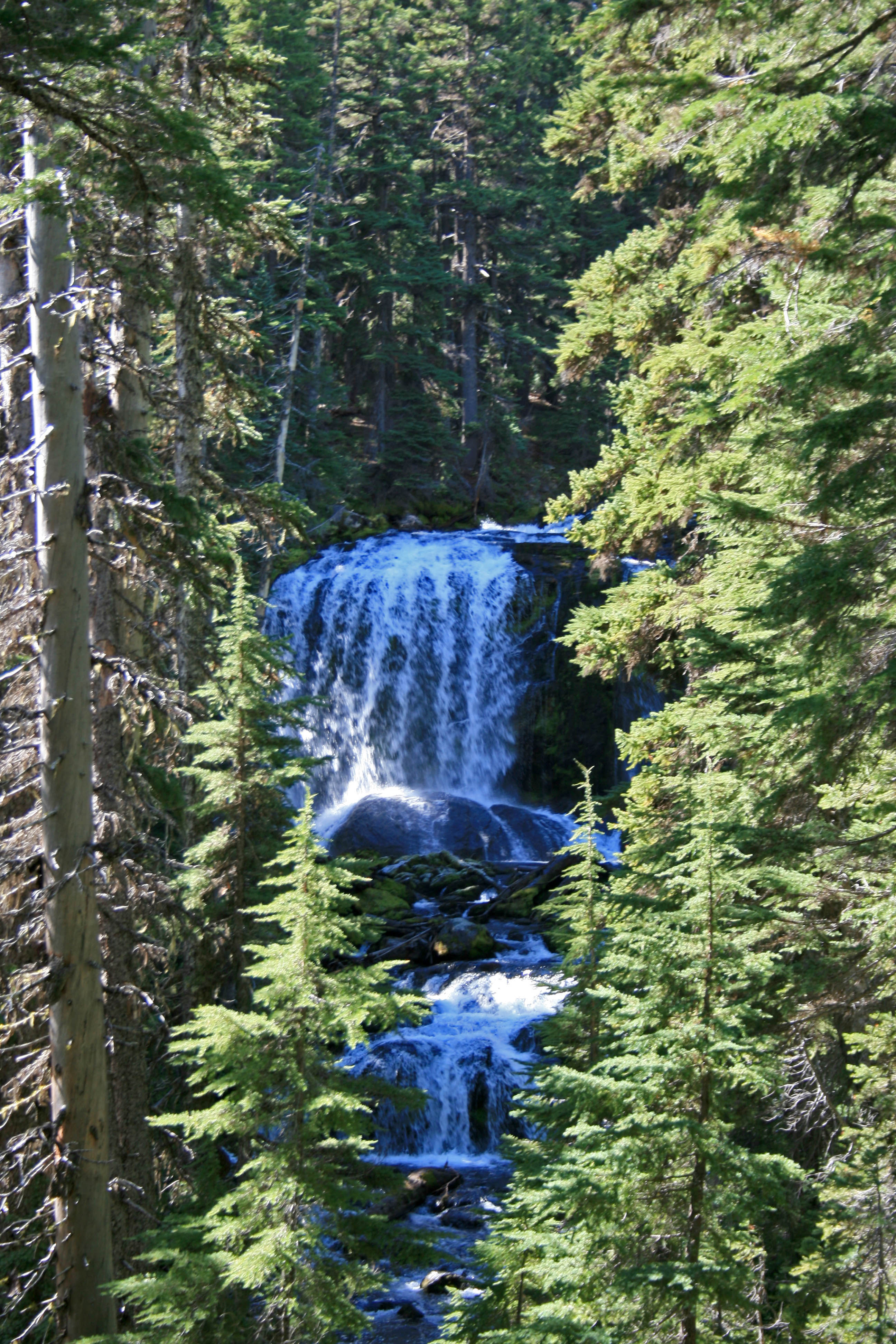
Dickey Creek is absolutely gorgeous at the creek crossing. Make sure to cross on the logs, it’s way easier than crossing on the mostly slippery rocks. I tried both… because I’m a glutton for punishment. I had my Tevas with me so I kicked off my boots and slipped into my Tevas for the first creek crossing and just walked straight across. I thought the water felt amazing, Steve thought it was frigid.

Big-slide-lake-dickey-creek

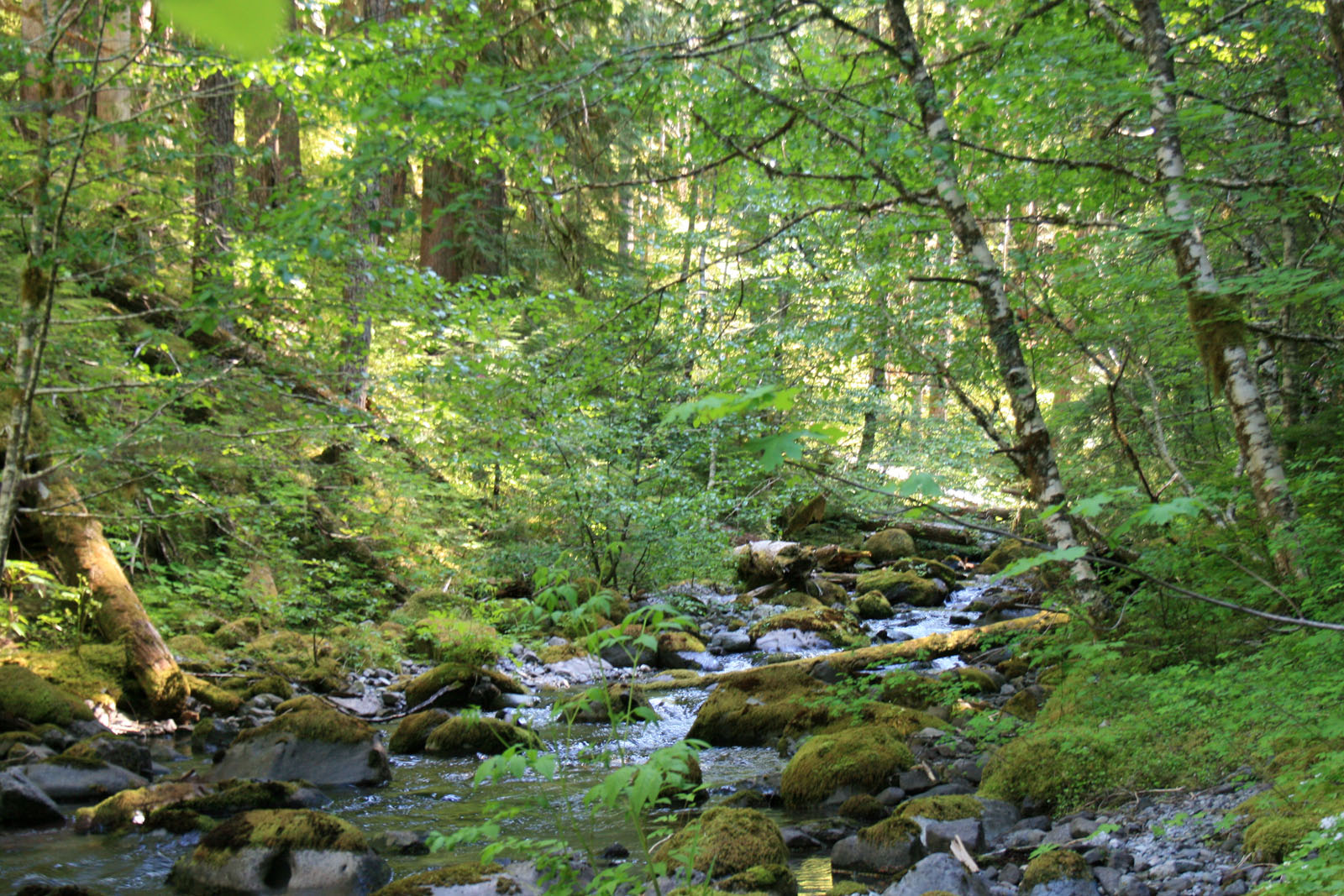
Dickey Creek at the Creek Crossing.

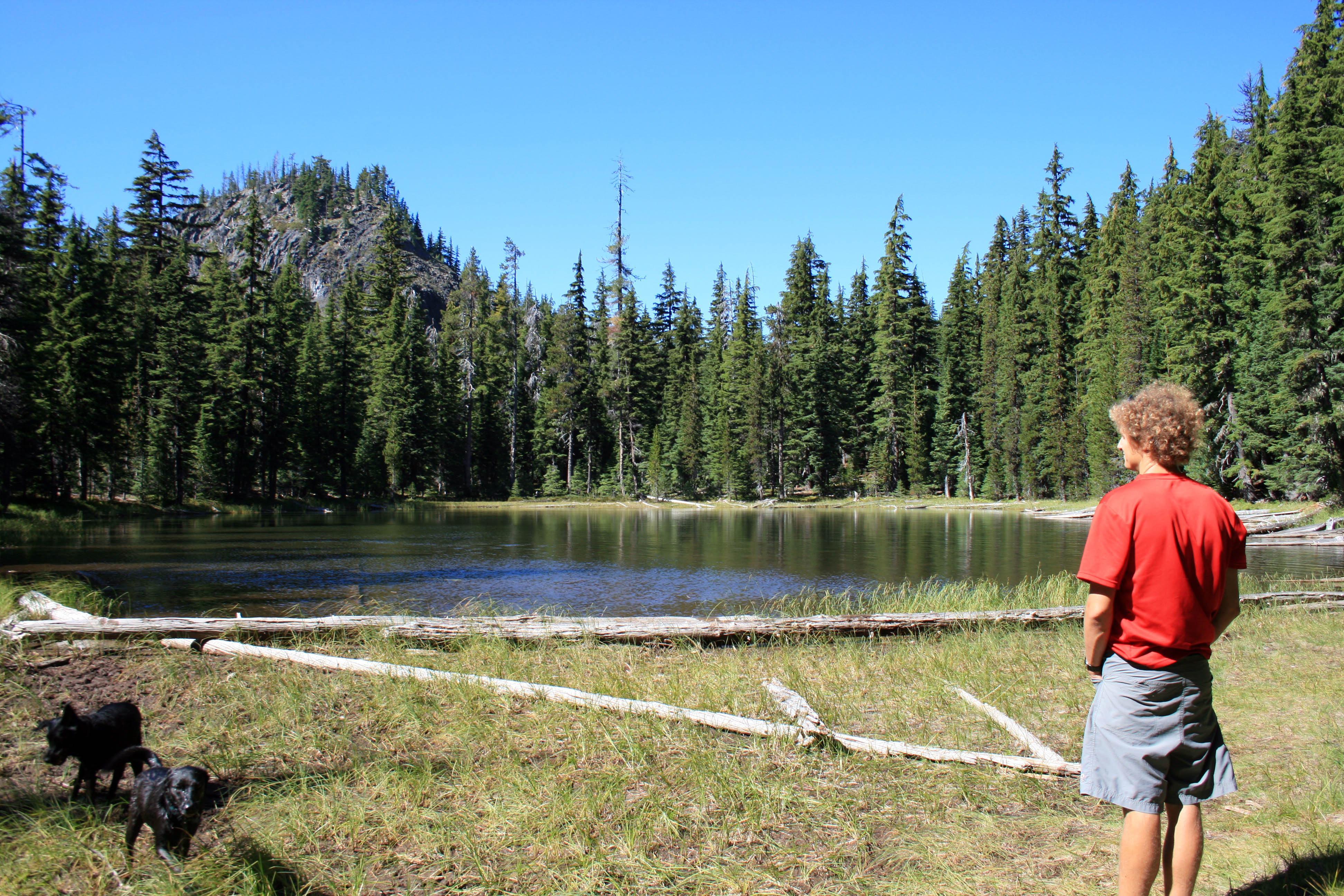
After the creek crossing the trail climbs up and up and up with no relief. I happen to enjoy uphill way more than the downhill slip and slide, but when you go up you must go down too. Eventually the trail splits (at a Y); veer right at the Y and head downhill to the lake and another easy creek crossing.
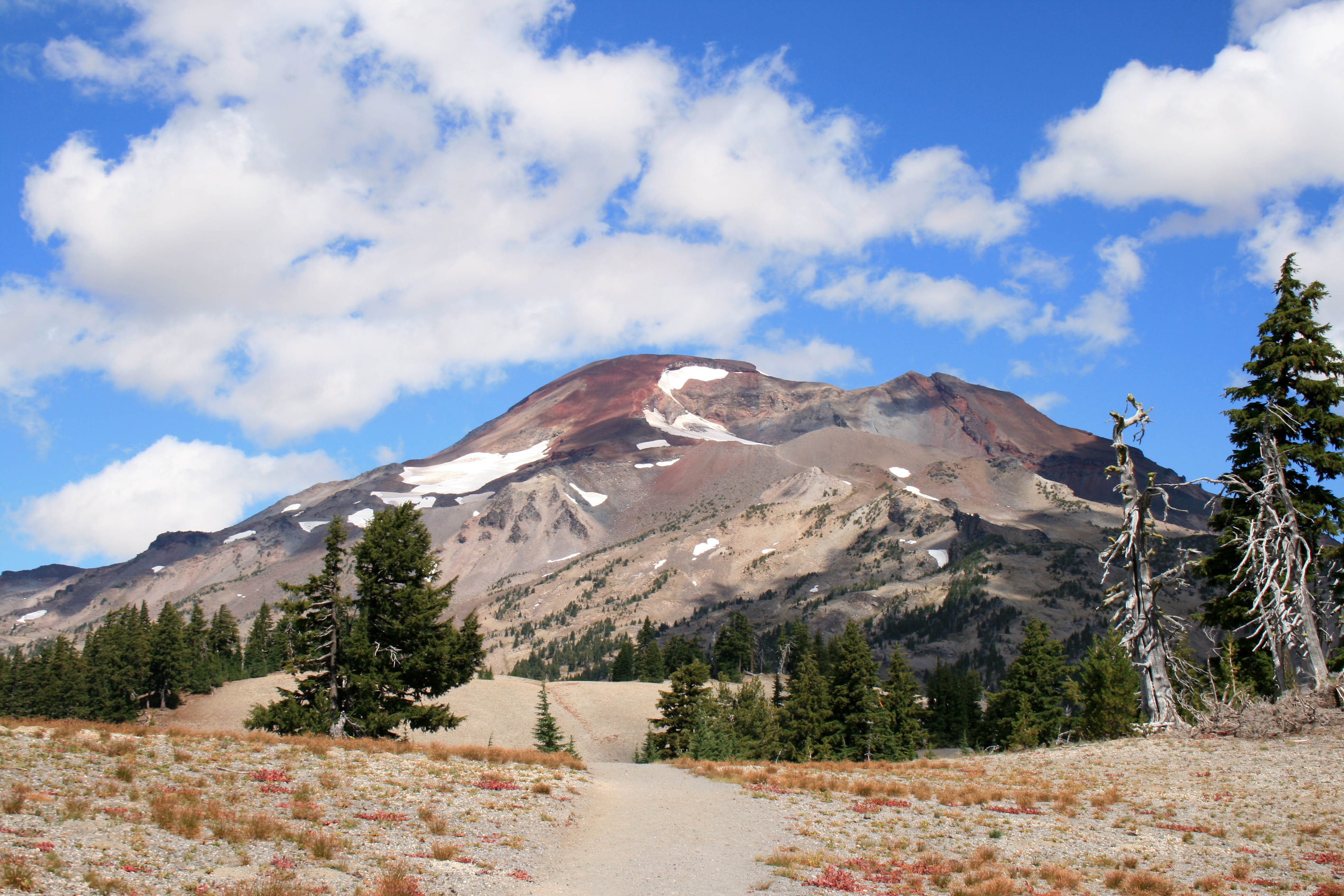
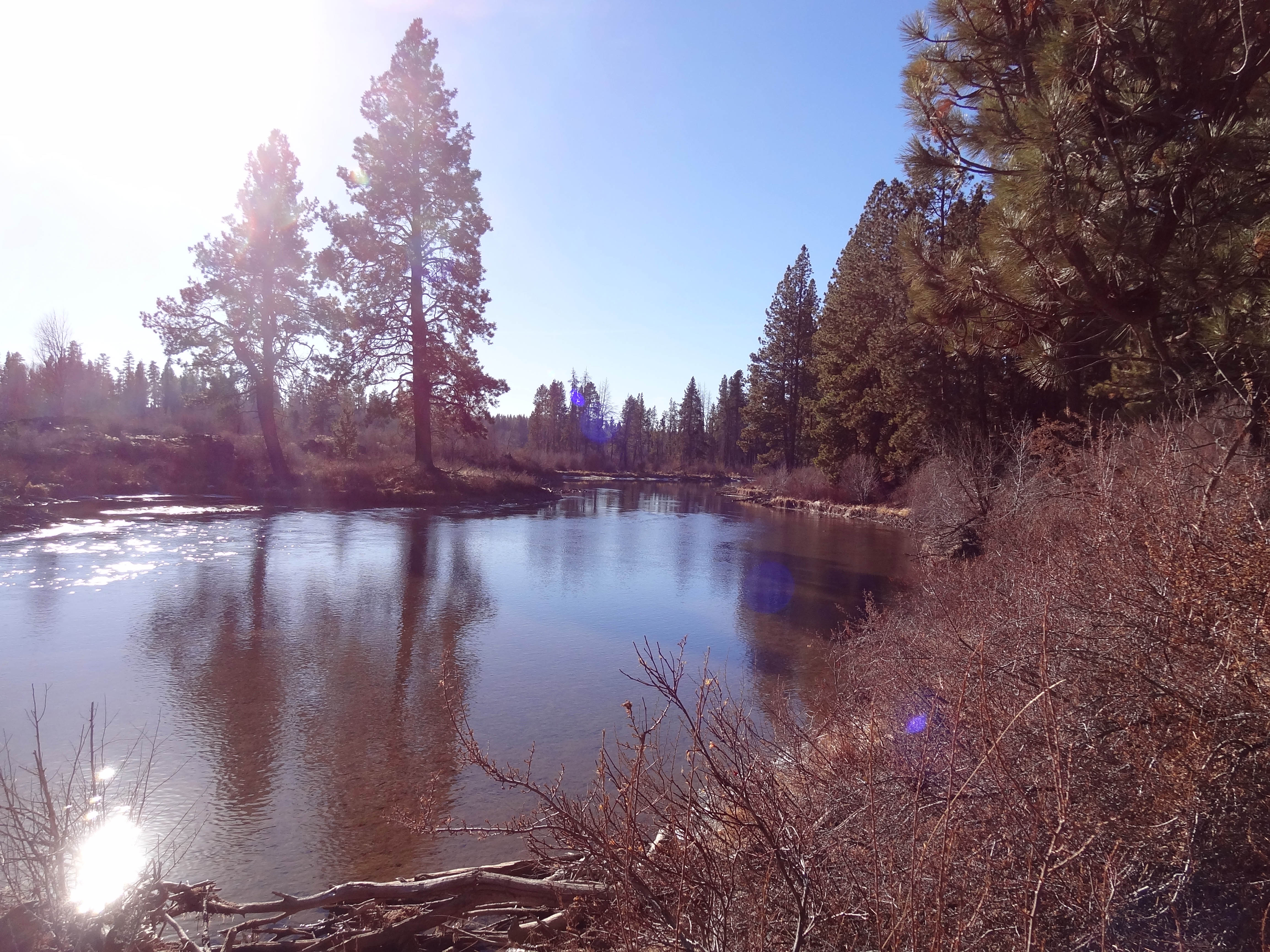
Blue skies

Blue skies

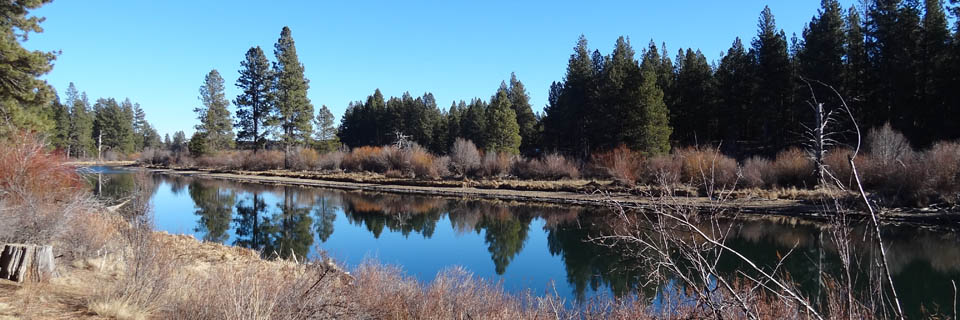
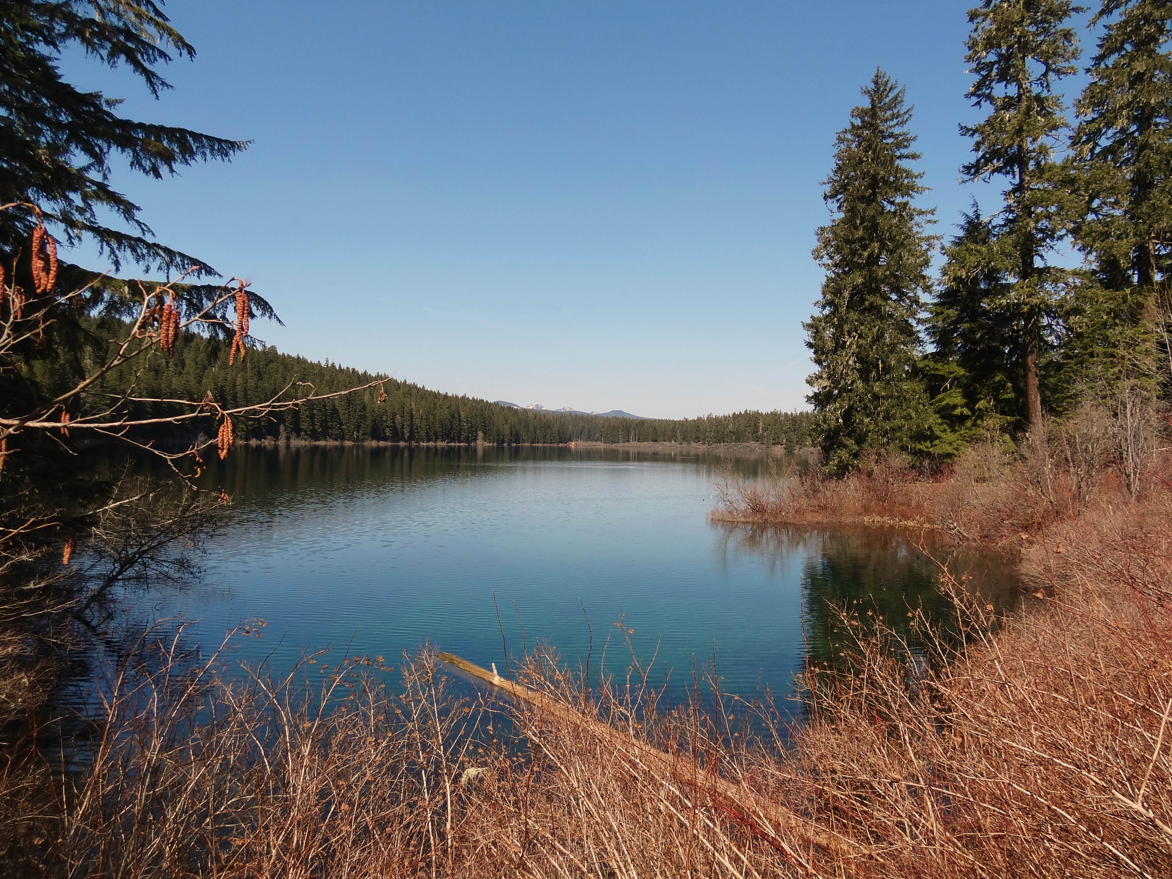
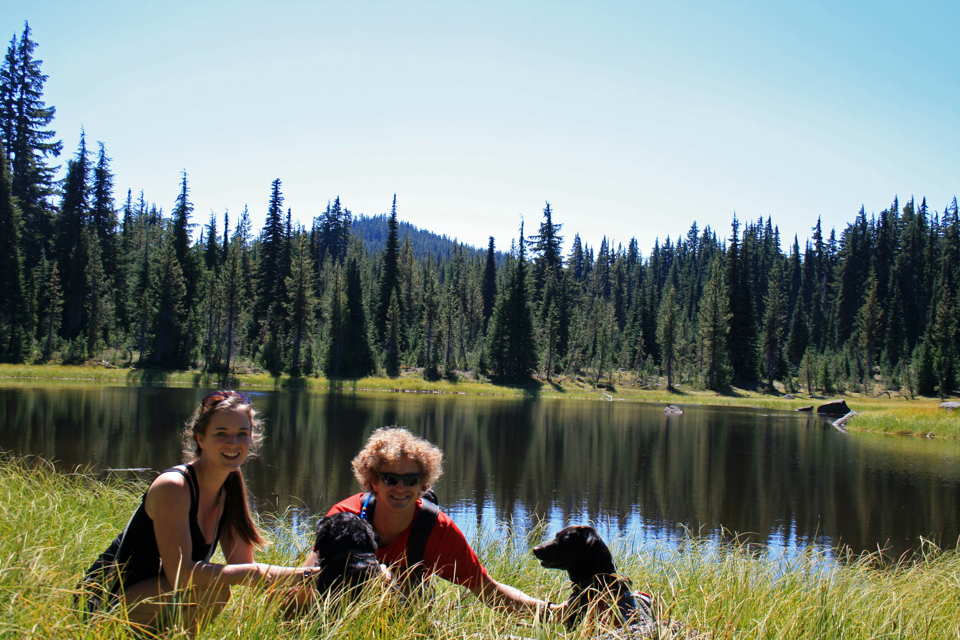
The lake is beautiful. It’s supposedly a great place for fishing, although we didn’t see any trout. We did see a ton of Salamanders swimming around though.

Big-slide-lake-island

Good morning!!!

I bet the water in the lake gets pretty warm during the summer. It looked pretty shallow all around….next time I’m packing a pool floaty.

big-slide-lake-june-wildflowers

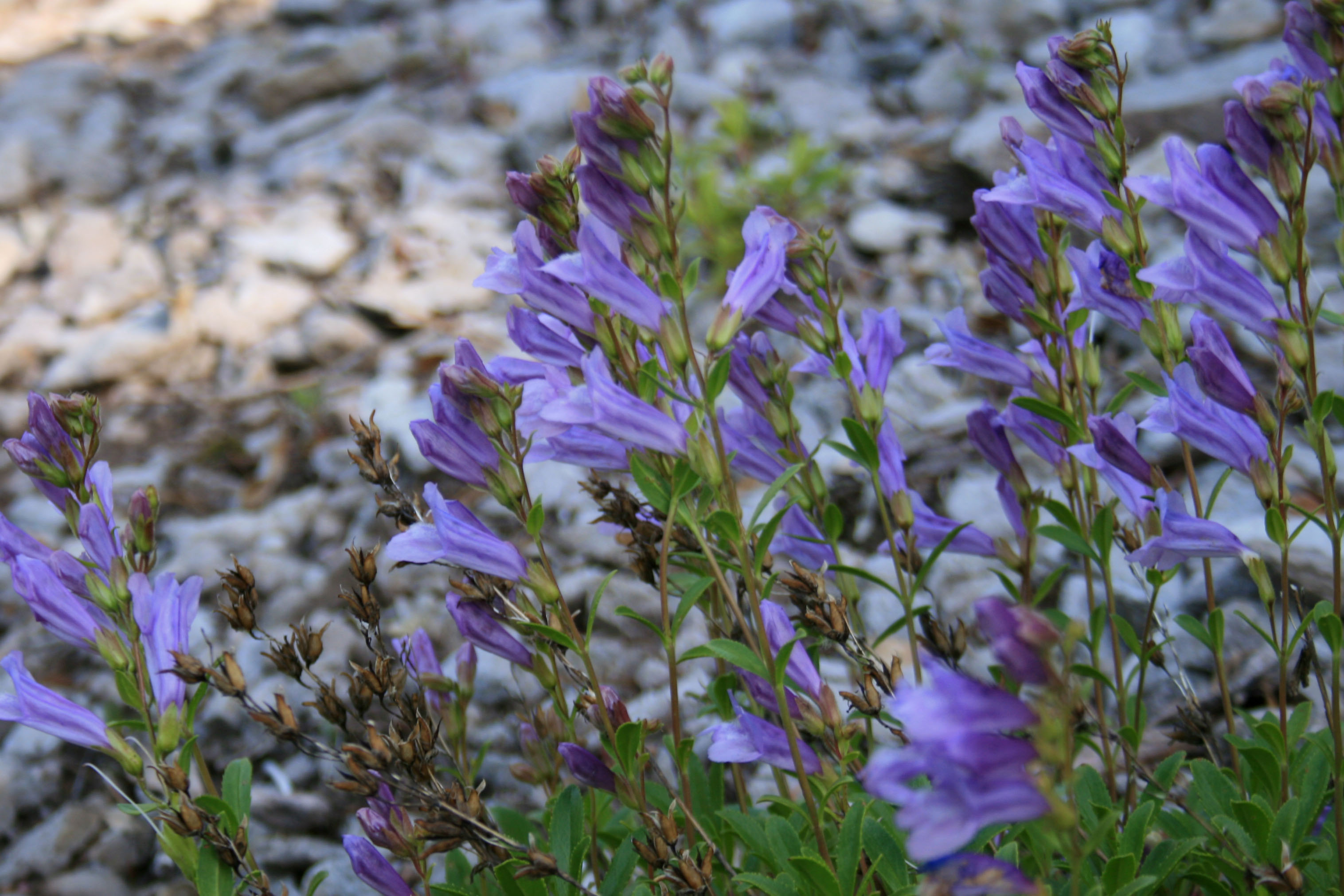
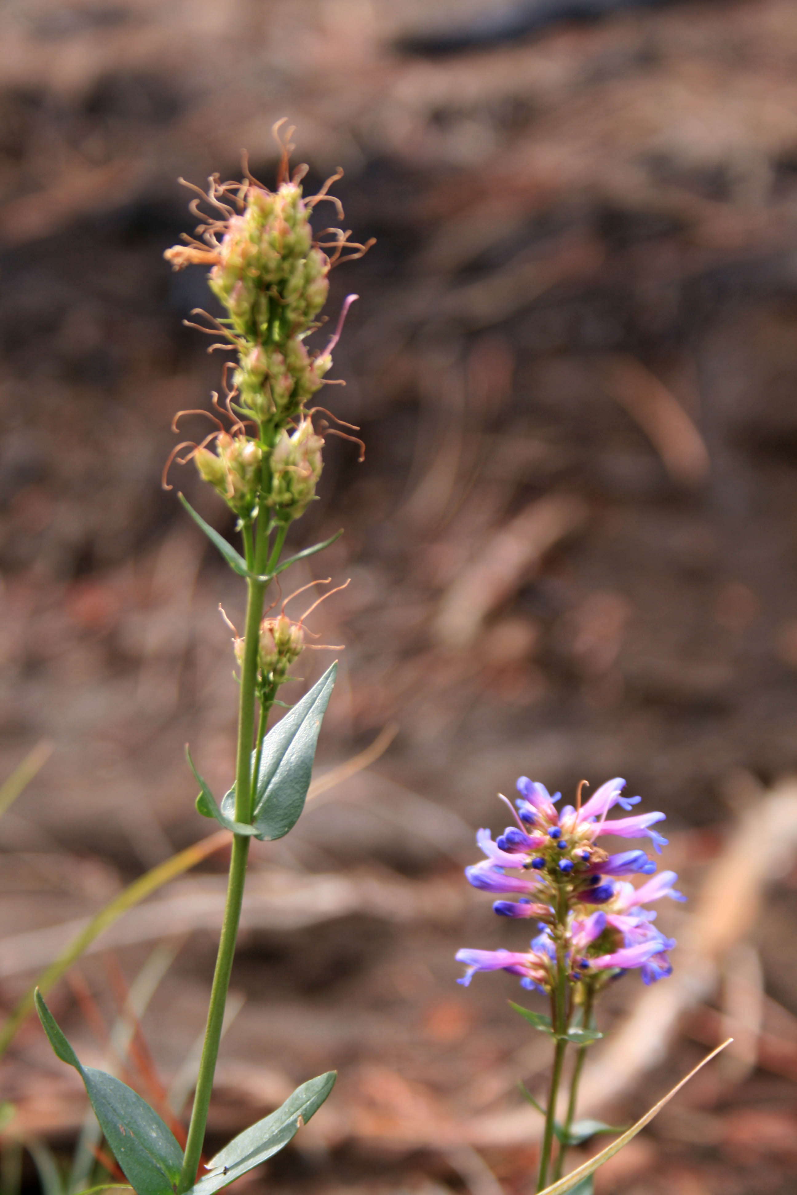
June wildflowers along the trail.

And the wildflowers. I love all the wildflowers this time of year. I’m not a flower buff and I don’t know the official names, but I do appreciate the beautiful color.

big-slide-lake-sal-morning-swim

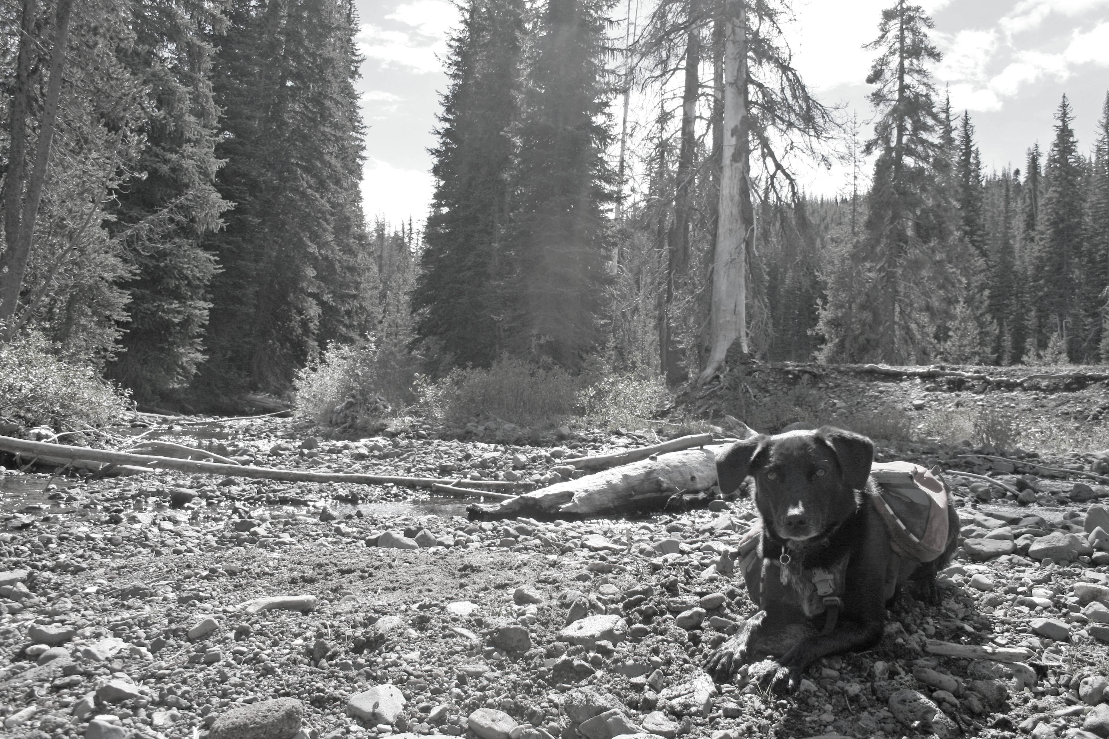
Sal hunting for salamanders….

So that’s Sal in picture above. He is our SUPER hyper-active pup, who’s not actually a pup anymore. He’s always game to play, whether it’s frisbee, ball, fetch, hunt for salamanders, jumping, climbing, acrobats, or rolling in nasty things. He has more energy than any other dog I’ve ever met.

Like I said in the Cons for this trail, most of the sites were already taken when we arrived at the lake. The only two sites that were still available were wedged between a group with two “dog aggressive” dogs and a group with a little girl, aged about 7, the type that Sal likes to eat for dinner. SO needless to say our sites were perfect (note sarcasm)!!!!

The first site was slightly more private, but as we were unpacking our backpacks Wonder Dog (Sal) found a lovely pile of unburied human feces and anointed himself with human shit; all over his face, neck, back, collar and harness. So we packed up and moved over to the tiniest site I’ve ever camped in…. but atleast it was further away from Sal’s poo fest. People please bury your feces…and don’t poo 15 feet outside of camp. I mean really???? I do not like having to bury other people’s poo and I’m pretty sure Steve didn’t enjoy washing someone else’s shit off of Sal.

big-slide-lake-trail-indian-paintbrush

indian paintbrush…. that’s probably not its real name

After cleaning up and setting up our micro-site we rewarded ourselves with some cabernet, thank god we packed it…. and it was well deserved. Neither of us lost our tempers… and we had a good laugh after the fact. I really wanted to call this hike Fecal Matters, but Steve vetoed it.

big-slide-lake-rhododendrons

Wild rhododendrons blooming.

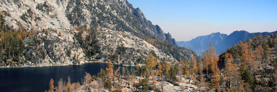
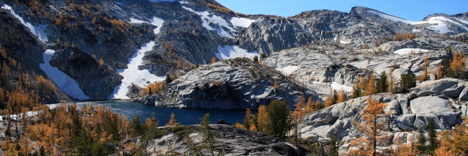
After Sal went for his morning swim we hit the trail. The morning air was nice and crisp and it was the perfect hiking temperature. Parts of the trail reminded me of the hike up to Snow Lake on the way into the Enchantments, but obviously on a much smaller scale.

big-slide-lake-trail

Many big slides…. I wonder how the lake got its name.

big-slide-lake-trail-sal

Parts of this trail reminded me of the Enchantments in Washington. (I think Sal is mean mugging me)

Sal loves to hike right on our heels, while Jedi is off in Jedi land with rainbows, glitter, and unicorns…. that’s why you don’t see any pics of him here.
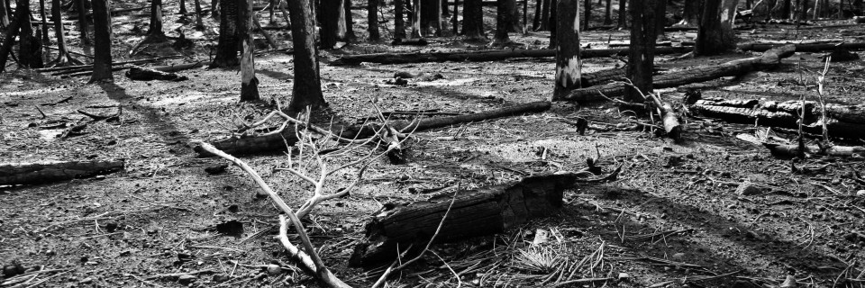
big-slide-trail-3

Deep green forest.

The trail in the woods was really lovely, super soft for walking, not too many roots/rocks, BUT you do have to climb over probably 20 down trees along the trail…it’s a fantastic core workout!!!

big-slide-lake-trail-2

Day on the trail.

We will definitely head back to the Bull of the Woods Wilderness. It was really pretty and felt incredibly remote. I kept hoping to see a bear or other wildlife, but no luck.

Resources

60 Hikes Within 60 Miles: Portland: Including the Coast, Mount Hood, St. Helens, and the Santiam River

Summit Post

Portland Hikers


A Weekend In Bend

So you’re planning a trip to Bend, huh? Maybe you’re coming for the killer mountain biking,  the brewery scene, or maybe just to get some more Vitamin D in your life. Steve and I have been living in Bend for 8 months now and we’re loving every minute of it. Need help deciding what to do on  your Bend holiday? Don’t stress… soon enough you’ll be in Bend. Here ya go! And you’re welcome, in advance.

1. Go Mountain Biking!!!

There are so many trails here and a fair number of them link up to each other. Try out the Deschutes River Trail for some easier trails or head over to Phils if you want to get crazy…. or link them up for an epic day of trail riding. Pine Mountain Sports, Bend Cyclery and Cog Wild are great resources for planning your trip.

Deschutes River Trail Lava Island Falls to Aspen

Mountain bike along the Deschutes River.

2. Get out on the Water!!!

Loose your fear of water and sign up for a kayak lesson with Tumalo Creek. Tumalo Creek is in the Old Mill District and literally right on the Deschutes River. Already comfortable on the water? Check out one of the whitewater trips they offer or try out SUP. I cannot wait for the days to be long and hot, so I can head out to Sparks Lake and Devils Lake for a little SUP action. Tumalo Creek also provides SUP lessons.

SUP at Tumalo Creek

SUP at Tumalo Creek

3. Hit the trail with your own two feet.

Try summiting South Sister or hiking into Green Lakes. You’ll have stunning views of Bachelor, Broken Top, and the Sisters. Legs sore from all the mountain biking? Try out the Deschutes River Trail. There are many loop options in town, but there are also options for out and back hikes that are gentle on aching bodies that take in beautiful waterfalls like Benham and Dillon Falls. Have time for a backpacking trip? Try out the Broken Top Loop or hike into Jefferson Park.

South Sister

The trail to South Sister.

4. Take a yoga class.

Yes, you can do yoga anywhere, but after all of the intense exercise your body will need a good stretch. My favorites: Juniper Yoga for hot sweaty yoga or a juicy yin class, The Yoga Lab for detailed instruction, and Groove Yoga for pumping music and a sweaty good time. Or schedule a private yoga session with Ambuja Yoga or Yoga Indigo.

Yoga at Pioneer Park

Yoga at Pioneer Park

5. Drink beer!!!

Okay this one’s a no-brainer. But if you don’t have time visit them all how do you choose? Well, my favorite is Crux Fermentation. They’re just off of Colorado Ave., east of 97. In my opinion they have the best beer in town…and they DEFINITELY have the best view in town. They have a huge patio and grassy lawn in which to hang out and appreciate the mountain views and chill with friends. Next up is Boneyard, in downtown Bend. They don’t serve food, there is nowhere to sit, and they only serve beer tasters and growler fills…. And Wednesday nights the growler fills are only 7 bucks!!!! BOOM!!! My third fave is Good Life, they have a handful of beers on tap and they have a nice big grassy area to chill and play lawn games…. lawn darts anyone? If you’re feeling particularly boozy try out the Ale Trail, just space it out over a couple of days, so you don’t make an ass out of yourself… we see it all too often.

Crux Fermentation

Crux all lit up at night.

6. Have Breakfast at The Victorian Cafe.

Breakfast at the Vic has got to be one of my favorite meals in town. Let’s start with the Proud Mary, a gigantic bloody mary with a grilled skewer of housemade sausage, cherry tomato, red onion and a prawn topped with a chunk of pepper jack cheese. The Proud Mary also has peperoncinis, green olives and a breadstick. Heaven!!! And for breakfast… eggs benedict. They’re the best in town and the specials are to die for… duck, wild boar, lobster….you name it, the Victorian has done a special with it. And don’t forget the french toast!!!! Warning: you may need to clear your schedule for the rest of the day.

Proud Mary at the Victorian Cafe

The Proud Mary….

7. Pre-hike/mountain bike coffee.

There is only one place in town that I visit regularly for a hot cup of joe and that’s Strictly Organic on Bond and Arizona. They usually have 4 different organic drip coffees available on top of all the foofy drinks. I’m partially addicted to their breakfast burritos (get the green salsa) and it’s one of my favorite places to meet friends for coffee or tea. They also have a patio to soak up the morning sun and a drive-up window for people on the go.

Strictly Organic

Strictly Organic’s patio.

I hope this helps you plan your weekend in Bend. If you have any questions send me a message.

Visit Bend‘s website has great info about things to do in town and a calendar of local events too.

McKenzie River Trail & Clear Lake

Koosah-falls-mckenzie-river-trail

Koosah Falls on the McKenzie River

The McKenzie River Trail is a super popular trail in the Cascade Range. It’s one that I’ve always skipped because I love alpine hiking. After a recommendation from one of my coworkers I figured it was about time to give it a shot, especially with all of the higher hikes still covered in snow.

Quick Stats

Distance: ~26 miles one way from end to end; we did a 12 mile loop taking in Koosah Falls, Sahalie Falls, and Clear Lake.

Time: ~ 5 hrs.

Difficulty: easy to moderate (moderate only due to distance)

Permits: None required

Pros: Beautiful waterfalls, whitewater, and a crystal clear lake

Cons: BUSY!!!! We were up there on a Sunday, once we were away from the falls it wasn’t quite as bad

Dog friendly: So-So, On weekdays it would be fine, but there were loads of people on the Waterfalls Trail, not as much fun for the dogs, but Clear Lake had great swimming for them. Part of the trail crosses lava rock on a paved path with no shade, might be too hot for their paws on a really hot day.

McKenzie-river-trail-view

View of the McKenzie River Trail…you can see it’s not that strenuous…. unless you’re on a mountain bike.

We started our hike at the Koosah Waterfall parking area off of Hwy. 126/McKenzie Hwy. The well maintained trail winds down to a couple of different viewpoints for Koosah Falls, where you will find loads of people snapping pics, it’s easy to understand why, Koosah Falls is stunning. From there we headed up toward Sahalie Falls, less than a mile away. Both of the waterfalls were gushing, yay springtime, and the McKenzie River is so clear, it is magical.

McKenzie_river_trail_sahalie_waterfall

Sahalie Falls

From the waterfalls the trail follows along the McKenzie river a bit further and then crosses highway 126 for Clear Lake, which is supposed to have the best diving in Oregon. There is a forest, that has been preserved by the cold waters, and you can dive through it/around it. The water in Clear Lake really was crystal clear and it looked deceptively like Caribbean water. So no misnomer here.

McKenzie_river_trail_clear_lake

Our first glimpse of Clear Lake

Sal and Jedi went for a dip in the chilly water and incidentally Steve and I ended up nearly  soaked after all of their frantic shaking (My prAna Halle Pants saved me). There were a handful of boats out on Clear Lake, just people out fishing, paddling around and enjoying the beautiful weather. I couldn’t help, but think how awesome it would be to take a standup paddleboard out on the lake. This summer for sure!

McKenzie_river_trail_clear_lake_sal

Typical…Sal playing catch with whatever stick he can find…no matter how cold the water is

We followed the trail around to the opposite side of Clear Lake, where we found a beautiful pool where water enters the lake through the lava rock. Amazing. I love nature. It’s so beautiful and I love how accessible it is in Oregon. We knew that we wanted to hike atleast 10 miles, but were up for more, so we just followed the trail passed the lake. It eventually crossed another road, followed the river for a bit more, and ended at the trailhead.

McKenzie_river_trail_clear_lake

A little further around the lake….you can really see how clear the water is!!!

McKenzie_river_trail_clear_lake_pool

Pool where water pours through the lava rock at Clear Lake

For our return hike we followed the path back to Clear Lake, then took the other path that lads around the opposite side, goes around a cove and through the Clear Lake Resort. We were pretty hungry, so we stopped for a snack, almonds, Gin-Gins, dried apricots, carrots, and cherry tomatoes for us and carrots and cherry tomatoes for the pups. They’re suckers for veggies. We continued on the path until it met up with the path that brought us to Clear Lake. We continued back the way we came, across the highway, until we came to a bridge that crosses over the McKenzie River. At this point we were on the Waterfall Loop portion of the Mckenzie River Trail, from here we had the opportunity to see the waterfalls (Sahalie and Koosah) from a different angle.

Bridge-mckenzie-river-waterfall-loop-trail

Crossing the bridge for the Mckenzie River Trail Waterfall Loop

The path follows along the river for a bit further. It then enters a parking area, where if you turn left and cross the bridge you can pick up the trail again just on the other side of the river. From here the rest is easy. Enjoy the views of the river for a bit more and then one last glimpse of Koosah Falls before heading up to the parking area.

Koosah-falls-mckenzie-river-trail

Koosah Falls, near the end of our hike.

Note: Portions of the trail are multi-use, which means mountain bikers will be on the trail too. This would be an epic day of mountain biking. There is a shuttle service here too, so you would just have to ride end-to-end. If you’re in the Bend area and don’t want to drive out to the trail, Cog Wild runs a shuttle a couple of days a week.

Finding the Beauty…

If you follow my blog regularly you’d think that I’m always going on perfect hikes with perfect weather and going on amazing trips with perfectly planned itineraries, but that is not the case. Often times we will head out for a hike/snowshoe etc. and are not able to get to the trailhead because of snow (or downed trees) or are not be able to find the trailhead at all… we’ll get lost or maybe even find that the trail is burnt or that the valley is so full of smoke you can’t see the nearby mountains. Our tent has been stolen, we’ve had large animals in camp, we’ve ran out of water with multiple miles still left and we’ve spent entire days walking in the rain. Traveling provides a whole different set of uncomfortable situations: not knowing the language or what you’re eating, getting sick, or perhaps spending hours or even days waiting for that bus or plane.

Kinabatangan Rain Storm

It can and will rain on your birthday…especially if you’re in the Bornean Rainforest…get ready to be soaked… I was happy to be wearing shorts for this boat ride.

These “not so fun,” surely uncomfortable, possibly disappointing, occasionally dangerous experiences are what we learn the most from. We can’t be afraid of the challenge….the only solution is to embrace it. Sometimes embracing the uncomfortable is nearly impossible, especially when you’re frustrated, exhausted and feel like screaming, but if you can do it, if you can stay in the moment, you might find something beautiful, something enjoyable.

Pole Creek Fire B/W2

A burnt forest means tons of wildflowers… well, after awhile anyway.

Pole Creek flower

Hello beautiful… I’m happy you’re here.

Some of my best experiences were born in uncomfortable moments….finding the lone flower in a burned out forest, sharing a meal of horse intestines with new friends, or rerouting a pre-planned itinerary. By embracing the uncomfortable, the disappointing, the challenging I have found freedom. SO let go of your expectations and find the beauty.

Sapa friends

Our friends treated us to a dinner of horse intestine and apricot wine followed by a trip to the love market.

Sapa friends love market

Helped the guys decide on new shirts at the Sapa Love Market.


Deschutes River Trail: Lava Island Falls to Aspen

Deschutes River trail lava island falls to Aspen

Steve and I couldn’t believe how beautiful it was….we did this hike in January and it was gorgeous!!!

Quick Stats

Distance: approx. 4 miles

Time: 2 hours (at a leisurely pace)

Difficulty: Easy

Dog Friendly: Yes, Off-leash in the wintertime

Permits: Yes, Northwest Forest Pass

Pros: Beautiful, easy trail minutes from town, option to make hike as easy or short as you like

Cons: Can be busy on weekends.

I love heading out to the Deschutes when I only have a couple of hours to kill. It’s so peaceful and the dogs can run and swim and act like maniacs. The trail is popular with dog-walkers because it’s off-leash part of the year and in some sections I think it’s off-leash all year. The trail doesn’t really gain any elevation in this section, just tiny amounts here and there. It follows right along the river and Lava Island is a bird sanctuary, so there are always birds to be seen….. and other “critters.”

Deschutes River Wildlife

Wildlife of the Deshutes River…. ROARRRR!!!

Also, you can’t actually see Lava Island Falls from the trail…if you want to see waterfalls head to Dillon Falls or Benham Falls, both along the Deschutes River trail.

Deschutes River Trail Lava Island Falls to Aspen

Sunny January day!!!

Even in winter the trail is accessible and used by bikers and hikers. And it’s easy enough that you’re friend who NEVER hikes would probably enjoy it. I never need much of a reason to get out here…it’s just so beautiful. In fact, I will probably head out here today….I need to break in my new Brooks Cascadia 9 Trail Runners anyway.

Deschutes River Trail Lava Island to Aspen

I love the old vintage-y look to this photo

Seriously we have seen lots of birds out here: hawks, owls, a bald eagle…. and tons of the usual suspects too.

Deschutes River wildlife

Look out for the T-Rex downriver!!!

To get to the Deschutes River Trail from Bend you just head west on Hwy. 46 for about 7 miles and then turn left (South) onto Forest Road 41, and then east on 4120. Super easy and less than 15 minutes from town!!!

Resources

Best Hikes with Dogs Oregonby Ellen Morris Bishop is indispensable. It’s one of our go to guides for Oregon.


Vista Butte Snowshoe

Vista Butte Autumn and Steve

We made it to the top!!! What a view!!!

This winter season hasn’t necessarily been the best for outdoor pursuits, but Steve and I have managed to go snowshoeing at Vista Butte Sno-Park twice this season. It’s literally a twenty minute drive, at most, from our house, it’s relatively easy and it has pretty decent views of Mt. Bachelor, South Sister and Broken Top. Honestly we like this trail because it is little used, so we can let the dogs run around and play in the snow without having to worry about them getting in the way of other snowshoers/skiers.

Quick Stats

Distance: 4 miles roundtrip

Time: 3 hours or less

Difficulty: moderate

Season: mid-December through March

Dog Friendly: Well…if you go to the Deschutes Forest Service site they say dogs are restricted, but the trail is little used, so I don’t think there is a big deal…just don’t leave doggy landmines around for unsuspecting snowshoers/skiers.

Pros: Close to Bend, not much trail traffic, terrific views with little work

Cons: Shares a busy parking space on the side of the highway with snowmobilers, crosses two snowmobile tracks

Permit: Sno-Park Pass required Nov.1 to May 1

Vista Butte view of Mt. Bachelor

Mt. Bachelor

To get to the trailhead head west on Highway 46 for about 18 miles. The Vista Butte Sno-Park is on the right side of Hwy. 46 and is literally just a wide space in the highway directly before the turnoff for Sunriver (Hwy. 45). The parking area for Vista Butte will probably have a handful of snowmobile trailers, but don’t worry you only see/hear them in a couple of places on the trail.

Vista Butte Sal and Jedi

Sal and Jedi in action!!!

For Steve and I this is a pretty easy snowshoe and I think most people in moderate shape will have an okay time with it. The trail gains around 700 ft over about 2 miles with the first quarter mile essentially completely flat. The trail gradually begins to gain elevation.

Vista Butte trail Steve

Loving the fresh air!!! And don’t forget the blue diamonds mark the way.

At about a half-mile in you will get a glimpse of your destination through the trees. And you’ll come to a junction with the lower loop trail. I’ve heard that the lower loop trail is more gradual, but we took the upper loop both times and it was beautiful, so I can’t tell you from experience. The trail does cross two snowmobile tracks, so be mindful and put your pups on leash, so no one gets hurt.

Vista Butte Ice 1

It was super icy when we went up the first time…pellets of ice everywhere.

Vista Butte Bachelor BW

Bring on the snow!!!

Cross the snowmobile tracks and stay on the Butte Trail. You’ll come to an area labeled Bruce’s Ballpark…I’m not sure what the story is behind that, but continue past it and head up the hill along the main trail. There are occasionally boot paths that take a short cut up to the top, but protect the plant life and stay as the trail….trust me it’s not much further. You will be stoked when you get to the top!!! You’ll be blessed with views of Bachelor, Broken Top and South Sister.

Vista Butte view of South Sister and Broken Top

South Sister on the left and Broken Top on the right.

Vista Butte Broken Top View

Broken Top peeking through the trees

Vista Butte View

Looking northeast… I think…

Return the way you came, or maybe check out the lower loop trail.

Vista Butte Ice

One more pic of the crazy ice!!!

Resources

Snowshoe Routes: Oregon by Shea Andersen
Deschutes Forest Service website


Tumalo Falls to Happy Valley

Quick Stats

Distance: 8 miles roundtrip (can also make a loop out of it if you want)

Time: 3 1/2-4 hours

Difficulty: Easy to moderate

Season: June to October

Permit: Northwest Forest Pass

Dog Friendly: Yes. Off-leash fun for most of the trail, but there are steep drop offs in places and the trail is used by mountain bikers….

Pros: Beautiful waterfalls, gentle trail, close to Bend, views of neighboring mountains and a pretty meadow.

Cons: Multi-use trail, parking lot can be full even on a weekday.

I’ve been eye-balling this area for a couple of years now, so I was pretty stoked to finally check it out. We hiked from the parking area up to Happy Valley, which is just under 4 miles one way. The trail winds through the forest at times, but mostly follows along the creek, allowing stupendous views of waterfalls and occasional access for a doggy dip.

Happy Valley trail waterfall

Waterfall peeking through the trees along the trail to Happy Valley.

Happy Valley waterfall2

One of the many waterfalls along the trail.

The trail is easy going, a nice gradual grade with some flat spots too… ie. much easier than most of the hikes we do. We had a non-hiker friend with us and she loved the hike and didn’t complain…maybe we can convert her?

It was a perfect cool fall day….rain was predicted for mid afternoon, so we turned around at Happy Valley after having a creek-side picnic.

Happy Valley Sal

Sal taking a break in the creek bed in Happy Valley.

Honestly this was an incredibly easy hike with beautiful scenery. It’s perfect for days when maybe you aren’t at 100% energy, you just want a quick jaunt out of town or you’re introducing a friend or child to the outdoors. And the trail is incredibly straight forward, no junctions, no “off trail” navigation…just beautiful trees and waterfalls.

Tumalo Falls

Bonus!!! You don’t even have to hike to see stunning Tumalo Falls…the viewpoint is practically in the parking lot.

And to keep our non-hiking friend happy, and to keep us happy too, we wrapped up our afternoon at 10 Barrel for a victory beer before heading home.


Sisters Mirror Lake

Sisters Mirror Lake family pic

The family at a little lake adjacent to Sisters Mirror Lake

Quick Stats

Distance: approx. 9 miles (more if you have time to explore)

Time: 4 1/2 hours

Difficulty: Easy to moderate with less than 1000 feet of elevation gain

Dog Friendly: Yes, it’s an off leash trail between Sept. 16 and July 14. You may run into pack animals and hunters, so know how your dog behaves around them.

Season: June to October

Permits: Northwest Forest Pass

Pros: you’re outside, close to Bend, tons of little lakes to explore and pretty meadows

Cons: No mountain views unless you head up Koosah Mountain (we only hiked up to an area where there was significant blow down, snapped a couple of pics and turned around)

This hike is so close to Bend it’s amazing that more people don’t use this trail. The trailhead was super easy to find; approximately 30 miles west of Bend on Cascade lakes Highway. There is a small parking area signed Mirror Lake Trailhead not too far passed Devils Lake (the trailhead for South Sister).

After a mile or two you come across a little pond with a large rock outcropping behind it, this is the last place for water until Sisters Mirror Lake.

sisters mirror lake pond

The last pond until you reach Sisters Mirror Lake.

Each of the lakes in the area make a perfect place for a picnic and soaking up some sun.

sisters mirror lake adjacent

Our lunch spot…all to ourselves

Sisters Mirror Lake skimps on the mountain vistas, but the large meadow, and pretty little surrounding lakes with their perfectly still surfaces totally make up for it. To find the lake you just follow the signs all the way there. There is atleast one place to camp on the far side of the lake and an even cuter place to camp at the neighboring unnamed lake (if you’re headed up Koosah).

Sisters mirror lake

Sisters Mirror Lake and a perfect fall day

I think it’s also possible to head over to Nash Lake and make a loop or balloon shaped hike… (check out a map first!!!)

You’ll reach the lake after about 4- 4 1/2 miles of hiking. And if you’re feeling good you could head down the PCT and up Koosah Mountain to get a little more burn in those quads.

South Sister from Koosah

South Sister from Koosah Mountain

To get back to your car just return the way you came….or if you end up doing the loop over to Nash Lake let me know how it goes.


South Sister Summit

South Sister summit Autumn and Steve

We made it!!!

Alright, I’m not gonna lie, I haven’t been on a serious hike since May when Steve, Angie, and I did the Pinnacles trek at Gunung Mulu National Park in Borneo. So naturally, summiting a 10,358 foot mountain would sound like a good idea. Why, oh why, do I do this to myself…

Steve and I usually hike alot, but we just got back from our 6 month trip to Asia, so the last month has been spent looking for a new home, a new car, and a new job (for yours truly). And we moved to the other side of the Cascades…hello sunshine!!!

Quick Stats

Distance: 12.23 miles roundtrip

Time: 7-10 hours

Difficulty: Very challenging, but nontechnical (ie. you don’t need climbing gear)

Season: All year (mid-summer to mid fall for hiking; the rest of the year it’s wise to carry crampons, snowshoes, ice axe, etc.)

Permit: Northwest Forest Pass required; Wilderness permit required, fill out your party’s details at the trailhead

Dog Friendly: Hell NO!!!! The volcanic rock would eat their little paws up; the trail to Moraine Lake would be fine though.

Pros: Views of the Cascades, summiting the third tallest mountain in Oregon, bragging rights, you could camp at Moraine Lake

Cons: SCREE, it’s exhausting, trail can be crowded

South Sister Sunrise1

Just above the clouds.

We were hoping to make the summit for sunrise, but quickly realized that there was no way we were going to be up there in time. We arrived at the trailhead around 3/3:30 am on Labor Day weekend….silly kids. Luckily, most people don’t want to hike in the dark, so we hit the trail and only saw two other groups ahead of us…..on the way down it was a different story; we probably saw close to 100 people on their way up. I’m so happy we started early.

South Sister Sunrise

Morning light on the glacier.

The hike itself is just over 12 miles roundtrip from the Devil’s Lake Trailhead and gains approximately 4,900 feet in about 6 miles. It’s a doozy. The hike from the Devil’s Lake trailhead up to Moraine Lake (about 1.5 miles up the hill) is easy enough and the trail is well packed, which you will definitely appreciate after hiking to the summit and back. If the trail up to Moraine Lake is tough for you, you might just want to call it a day and enjoy the lake. It looked beautiful from up above and it would be way more relaxing than a summit attempt.

South Sister Sunrise above the clouds

Steve waiting for me to catch up.

South Sister lakes

You can see a few of the lakes in this pic and the ridge we hiked up.

I love scree!!! Oh wait, no I don’t. I hate it. It freaks me out! And the summit trail is mostly scree…loads and loads of loose volcanic rock. I definitely had to suck it up and resist the urge to turn around. My fear of falling was overpowering…I’m not truly afraid of heights; I’m afraid of tumbling down a hill. Anyway, I eventually made it to the top, probably 20 minutes after Angie and Steve. They patiently waited for me while there fingers, hands, limbs, and faces froze. The view was beautiful from the top, but it was bitterly cold and even operating the camera was a challenge.

South Sister Summit Autumn and Angie

Angie and I took a quick pic before hustling down the mountain to get warm.

Anyway I’m happy to check the South Sister off of the list, but I’m not exactly jumping at the chance to do it again. Will I do it again? Probably, but I need to forget about all of that scree before I even consider it…lol. Maybe they could build some stairs and a put little hot chocolate shop on the summit? Just kidding….it was beautiful, it just so happens that it was really challenging too.

South Sister Steve

Beautiful lake on the way down from the summit…maybe Tear Drop Lake?

South Sister

Check!!!


Notes: Pack your layers. I wore a tank, a Smartwool Midweight top, a vest, a lightweight jacket, leggings, thin gloves and a fleece headband. Honestly, I wish I had brought my Patagonia Down Sweater too. I was fine in boots with no gaiters, but I went fairly slowly. My trekking poles also came in handy, but like I said I was going slow. I saw some people running down in tennis shoes. Pack your sunscreen and sunglasses too. You will definitely need them as there isn’t much shade on the trail until below Moraine Lake.

Resources

Everytrail.com provides a play by play trail guide


Jefferson Park Wilderness

Quick Stats

Distance: 13 miles

Time: 2+ days

Difficulty: moderate to difficult (approx. 3000 ft. gain)

Season: July to October

Permit: Northwest Forest Pass required

Dog Friendly: Yes, the trail doesn’t have much for steep drop offs, there is regular water access, and plenty of shade (aside from a couple sections that seem unrelenting) Note: some sections are kinda rocky…so know your pooches limits…especially if they have sensitive paws. Our dogs were plenty excited for a post hike swim…and it was hard to keep them out of the water.

Pros: Wildflower filled meadows, multiple stream crossings for yourself and your furry friends, views of Mt. Jefferson, alpine lakes

Cons: Busy…tons of people…and what they leave behind. We ended up burning a bunch of TP…it seems many of Jefferson Park’s backpackers have forgotten the principle of leave no trace; there is also a fire ban usually util September or October. We hardly passed anyone on the South Breitenbush trail, but Jefferson Park was quite busy.

View of Mt. Jefferson

One of the many great views of the mountain.

Jefferson Park is one of those fabled gems that my parents still speak fondly of…many, many years after their first visit. And it’s true, the scenery is absolutely stunning and so worth every ounce of sweat to get there. Following the South Breitenbush trail you’re graced with a rushing river, a damp forest, open vistas, meadows bursting with wildflowers, views of Mt. Jefferson, and crystal clear alpine lakes….what more can a backpacker ask for? Well, I guess some solitude would be nice too.

mt. jefferson and jefferson park

Even Sal stopped to admire the view.

Most people take the Whitewater trail or the Park Ridge trail into the park, but we wanted a more challenging hike with fewer people, and that’s exactly what we got. There was only one other car in the parking lot and when we hiked out the next day there were only two other cars. I would definitely hike this trail again, but I am interested in checking out the other two as well.

Over the first 1 1/2 miles the trail passes multiple little creeks and begins gaining elevation pretty quickly. The trail continues on a generally uphill path for the next few miles. If you’re feeling inclined to punish yourself further at about two miles in there is a junction with the Bear Point trail…I’m sure there are great views, but we simply weren’t interested.

After the Bear Point junction the trail gets steeper, rockier and more exposed. If you’re game to leave the trail by a couple of dozen feet you might find a partial view of Mt. Jefferson.

Jefferson wildflowers

Tons of wildflowers carpeted the meadow just before reaching Jefferson Park.

Once you’re about 3 1/2 miles in you’ll stumble into a gorgeous meadow and you’ll forget all about the trudge up the hill. The  trail meanders through the meadow, running along the streams and around little ponds.

jefferson flowers2

Still more flowers!!! and a view of one of the neighboring buttes.


After about three miles more you will finally enter Jefferson Park with it’s postcard perfect views of the mountain and it’s jewel toned lakes. There are three main lakes here: Russell, Scout and Bays. It’s important to note that camping is ONLY allowed at the spots marked by a post. The area has been loved to death by it’s biggest fans, so please tread lightly, leave no trace, and respect the wilderness. Park rangers are more than happy to fine those who build a fire (during the ban) and/or camp outside the designated spots.

jefferson view from camp

Our view from camp overlooking Russell Lake.

To complete the hike, you simply return the way you came.

jefferson park lakes

Peek-a-boo views of the lakes entice you to wander.

Mt. Jefferson with Russell Lake

Mt. Jefferson with Russell Lake in the foreground.

There are many options for daytrips from Jefferson Park and I think it would be worth it to stay an extra day or two. You could hike up to Park Ridge for the view of Mt. Jefferson, explore the many lakes, amble along a section of the PCT…you get the picture.