Sisters Mirror Lake

Sisters Mirror Lake family pic

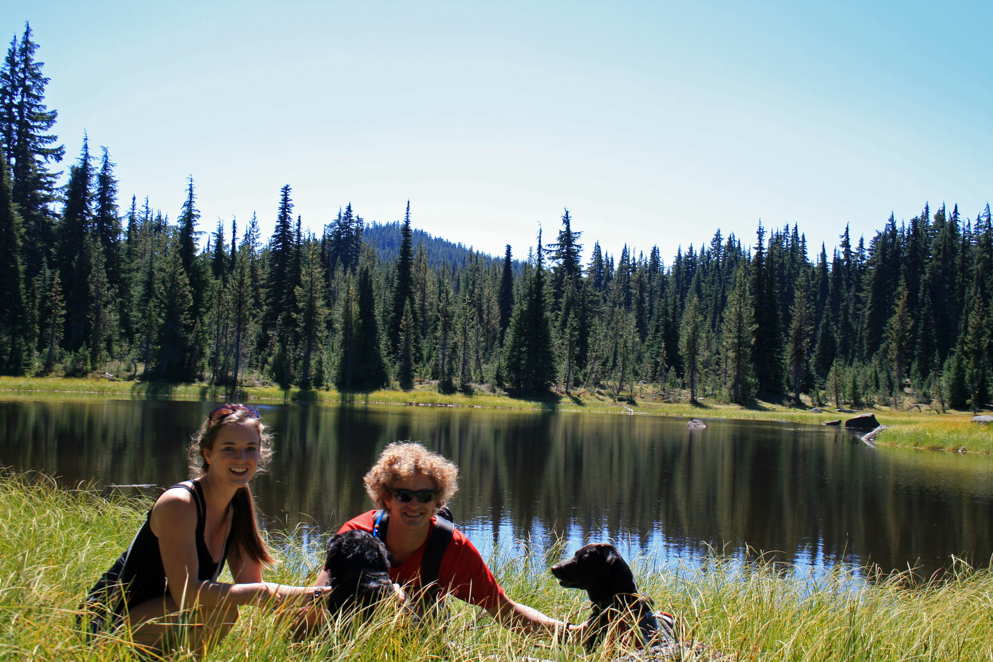
The family at a little lake adjacent to Sisters Mirror Lake

Quick Stats

Distance: approx. 9 miles (more if you have time to explore)

Time: 4 1/2 hours

Difficulty: Easy to moderate with less than 1000 feet of elevation gain

Dog Friendly: Yes, it’s an off leash trail between Sept. 16 and July 14. You may run into pack animals and hunters, so know how your dog behaves around them.

Season: June to October

Permits: Northwest Forest Pass

Pros: you’re outside, close to Bend, tons of little lakes to explore and pretty meadows

Cons: No mountain views unless you head up Koosah Mountain (we only hiked up to an area where there was significant blow down, snapped a couple of pics and turned around)

This hike is so close to Bend it’s amazing that more people don’t use this trail. The trailhead was super easy to find; approximately 30 miles west of Bend on Cascade lakes Highway. There is a small parking area signed Mirror Lake Trailhead not too far passed Devils Lake (the trailhead for South Sister).

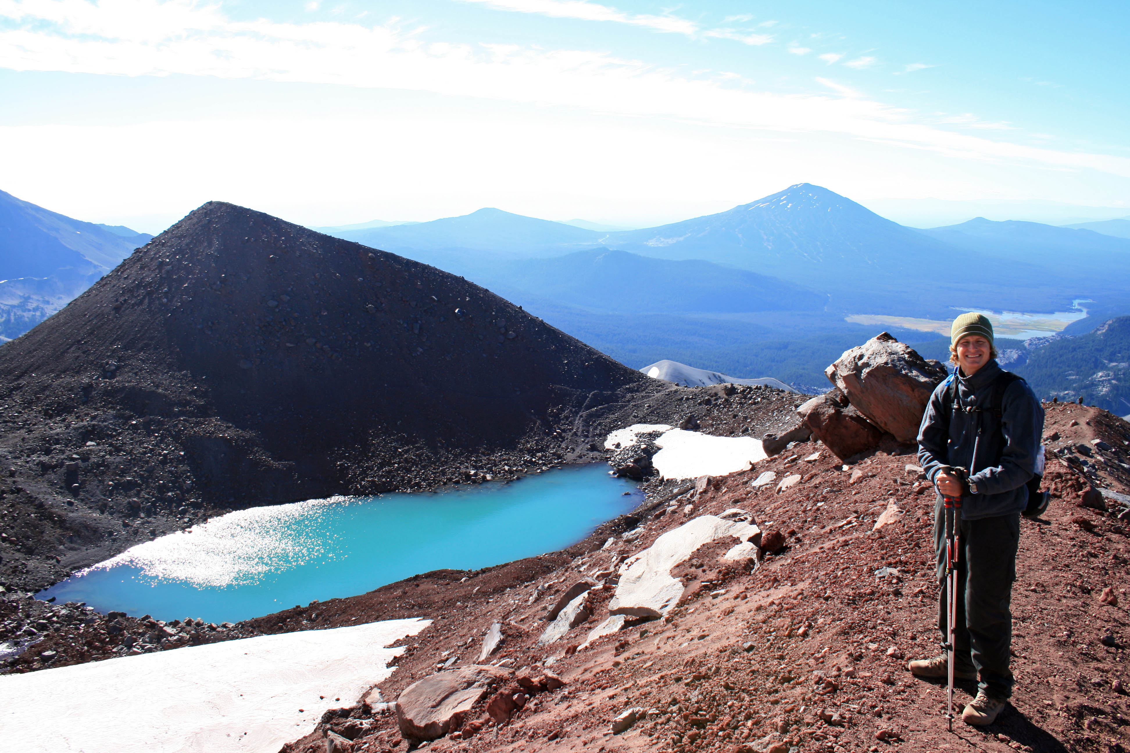
After a mile or two you come across a little pond with a large rock outcropping behind it, this is the last place for water until Sisters Mirror Lake.

sisters mirror lake pond

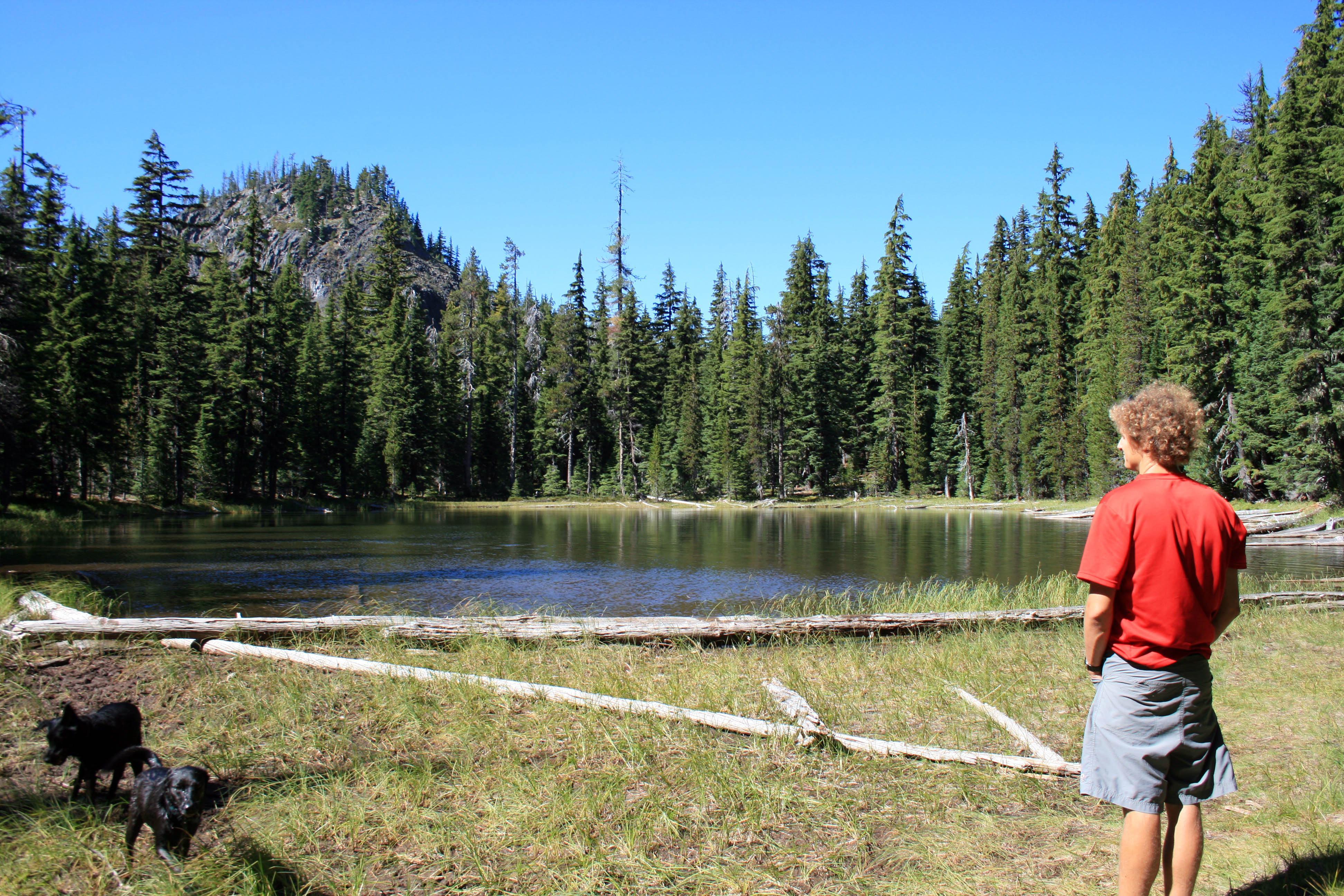
The last pond until you reach Sisters Mirror Lake.

Each of the lakes in the area make a perfect place for a picnic and soaking up some sun.

sisters mirror lake adjacent

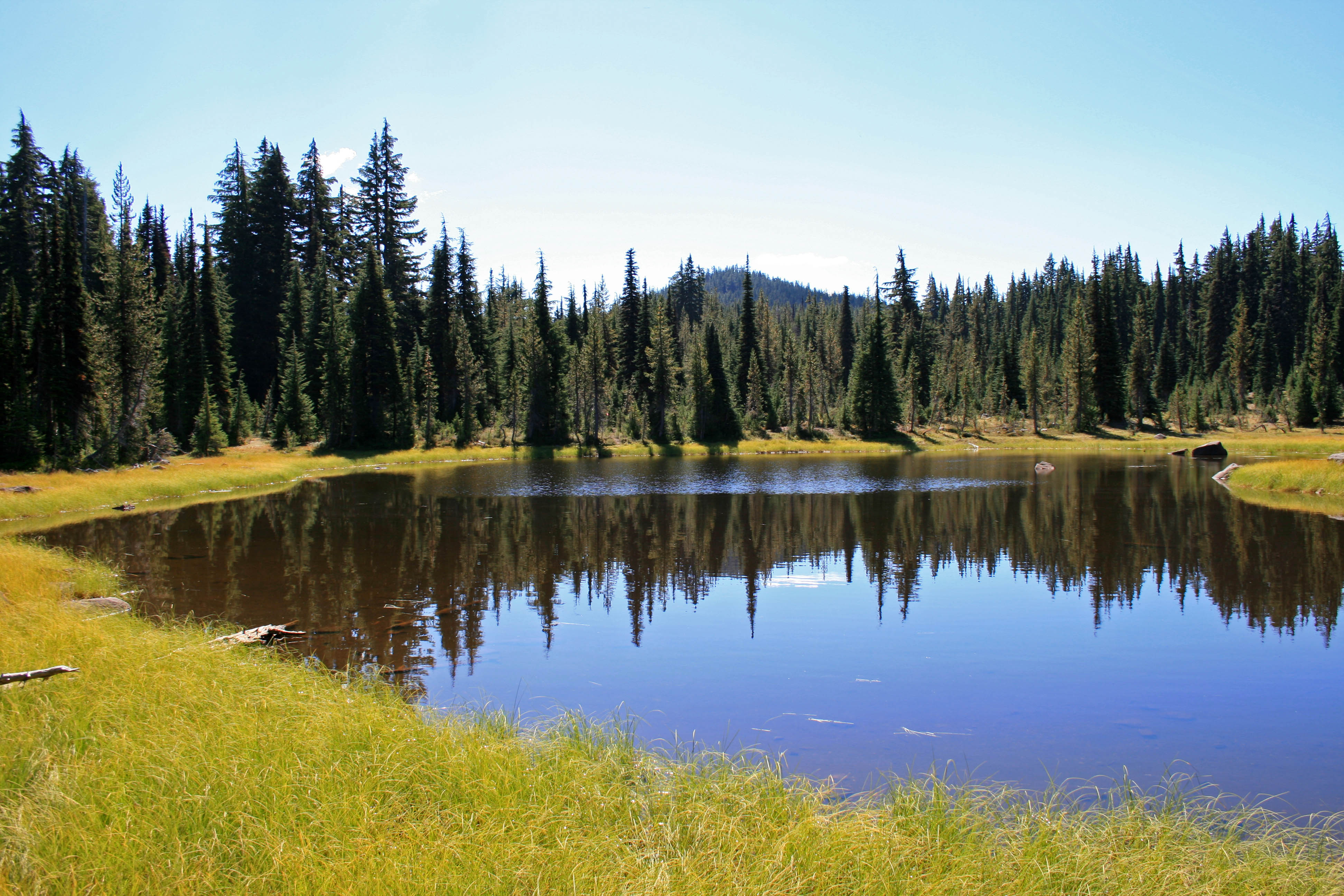
Our lunch spot…all to ourselves

Sisters Mirror Lake skimps on the mountain vistas, but the large meadow, and pretty little surrounding lakes with their perfectly still surfaces totally make up for it. To find the lake you just follow the signs all the way there. There is atleast one place to camp on the far side of the lake and an even cuter place to camp at the neighboring unnamed lake (if you’re headed up Koosah).

Sisters mirror lake

Sisters Mirror Lake and a perfect fall day

I think it’s also possible to head over to Nash Lake and make a loop or balloon shaped hike… (check out a map first!!!)

You’ll reach the lake after about 4- 4 1/2 miles of hiking. And if you’re feeling good you could head down the PCT and up Koosah Mountain to get a little more burn in those quads.

South Sister from Koosah

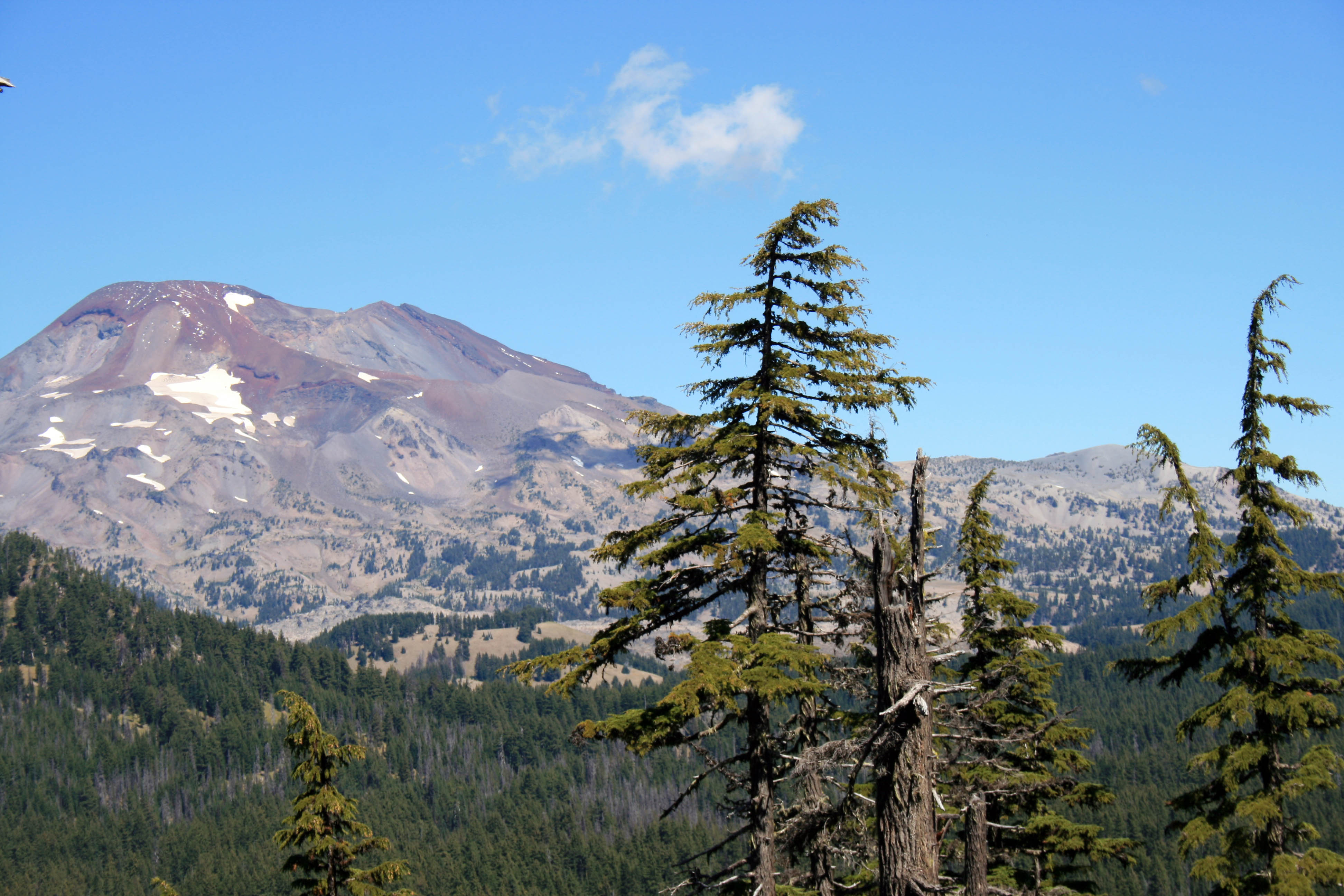
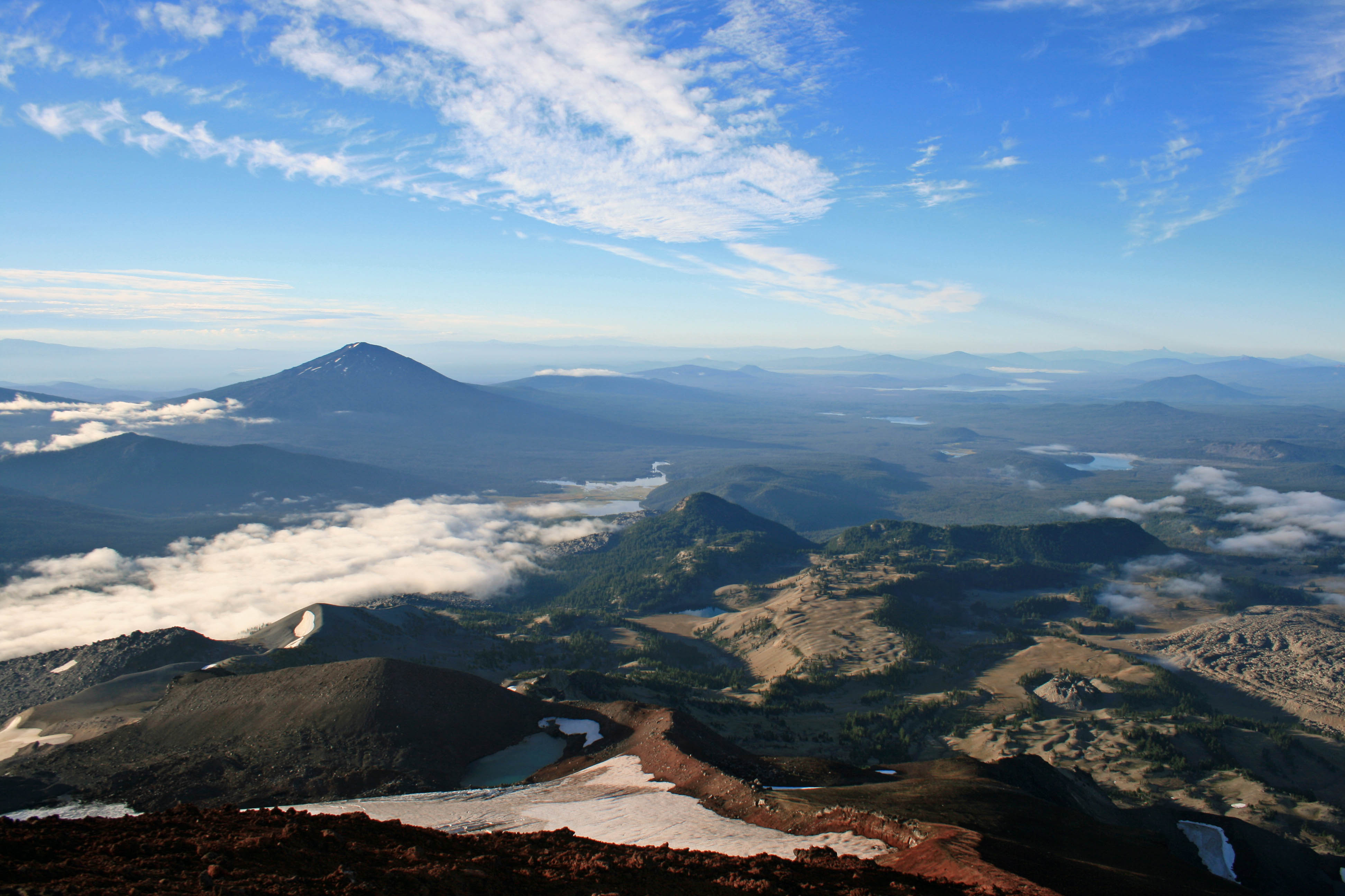
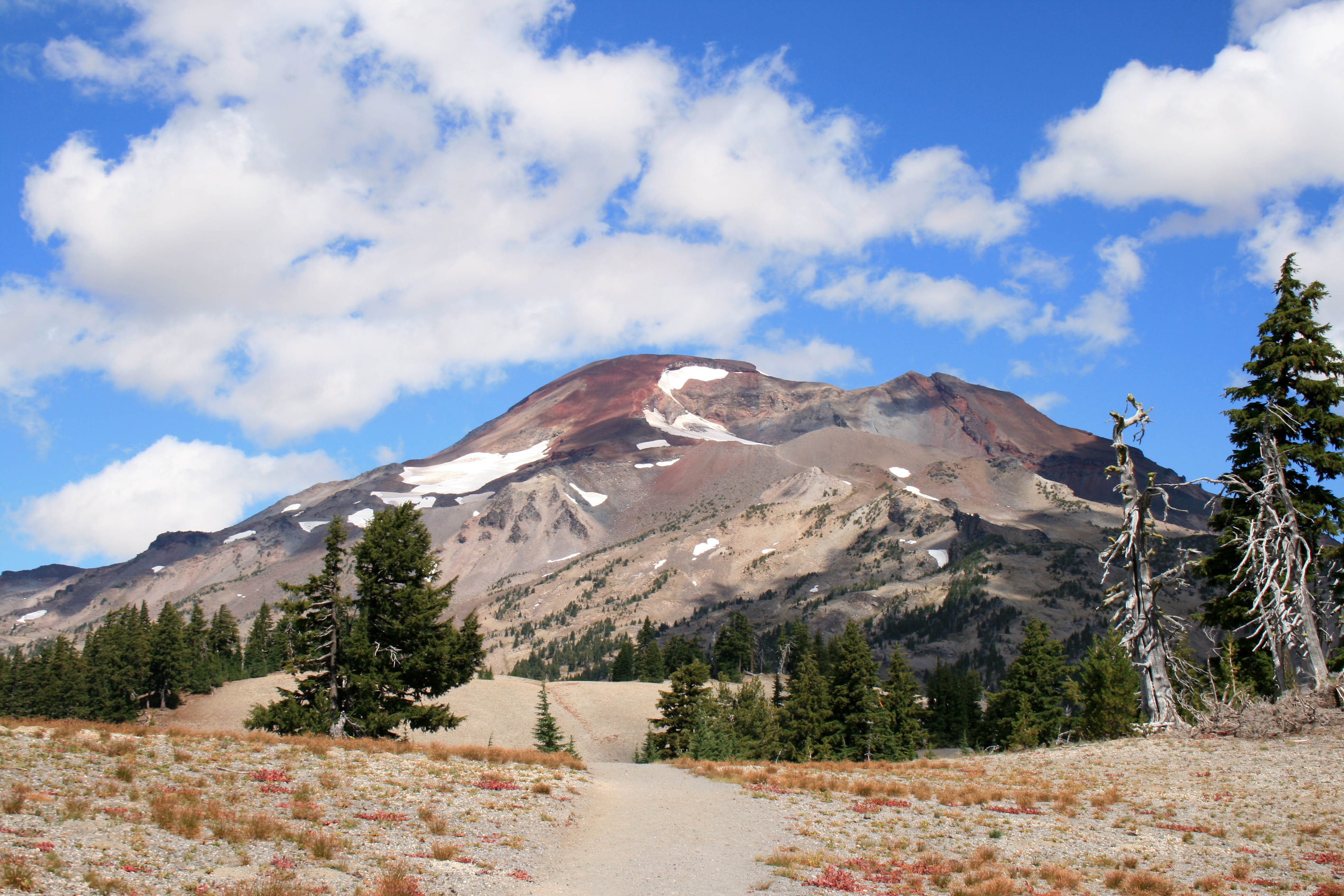
South Sister from Koosah Mountain

To get back to your car just return the way you came….or if you end up doing the loop over to Nash Lake let me know how it goes.


Pic of the Week

Laos slow boat

Boats waiting for passengers on the river from Thailand to Luang Prabang.

The beginning of a two day river trip from the Thai-Laos border to Luang Prabang. The disorganization at Immigration should have been a sign…LPDR = Laos Please Don’t Rush

We were really able to enjoy our trip down the Mekong River….it’s kinda like forced relaxation! :)

South Sister Summit

South Sister summit Autumn and Steve

We made it!!!

Alright, I’m not gonna lie, I haven’t been on a serious hike since May when Steve, Angie, and I did the Pinnacles trek at Gunung Mulu National Park in Borneo. So naturally, summiting a 10,358 foot mountain would sound like a good idea. Why, oh why, do I do this to myself…

Steve and I usually hike alot, but we just got back from our 6 month trip to Asia, so the last month has been spent looking for a new home, a new car, and a new job (for yours truly). And we moved to the other side of the Cascades…hello sunshine!!!

Quick Stats

Distance: 12.23 miles roundtrip

Time: 7-10 hours

Difficulty: Very challenging, but nontechnical (ie. you don’t need climbing gear)

Season: All year (mid-summer to mid fall for hiking; the rest of the year it’s wise to carry crampons, snowshoes, ice axe, etc.)

Permit: Northwest Forest Pass required; Wilderness permit required, fill out your party’s details at the trailhead

Dog Friendly: Hell NO!!!! The volcanic rock would eat their little paws up; the trail to Moraine Lake would be fine though.

Pros: Views of the Cascades, summiting the third tallest mountain in Oregon, bragging rights, you could camp at Moraine Lake

Cons: SCREE, it’s exhausting, trail can be crowded

South Sister Sunrise1

Just above the clouds.

We were hoping to make the summit for sunrise, but quickly realized that there was no way we were going to be up there in time. We arrived at the trailhead around 3/3:30 am on Labor Day weekend….silly kids. Luckily, most people don’t want to hike in the dark, so we hit the trail and only saw two other groups ahead of us…..on the way down it was a different story; we probably saw close to 100 people on their way up. I’m so happy we started early.

South Sister Sunrise

Morning light on the glacier.

The hike itself is just over 12 miles roundtrip from the Devil’s Lake Trailhead and gains approximately 4,900 feet in about 6 miles. It’s a doozy. The hike from the Devil’s Lake trailhead up to Moraine Lake (about 1.5 miles up the hill) is easy enough and the trail is well packed, which you will definitely appreciate after hiking to the summit and back. If the trail up to Moraine Lake is tough for you, you might just want to call it a day and enjoy the lake. It looked beautiful from up above and it would be way more relaxing than a summit attempt.

South Sister Sunrise above the clouds

Steve waiting for me to catch up.

South Sister lakes

You can see a few of the lakes in this pic and the ridge we hiked up.

I love scree!!! Oh wait, no I don’t. I hate it. It freaks me out! And the summit trail is mostly scree…loads and loads of loose volcanic rock. I definitely had to suck it up and resist the urge to turn around. My fear of falling was overpowering…I’m not truly afraid of heights; I’m afraid of tumbling down a hill. Anyway, I eventually made it to the top, probably 20 minutes after Angie and Steve. They patiently waited for me while there fingers, hands, limbs, and faces froze. The view was beautiful from the top, but it was bitterly cold and even operating the camera was a challenge.

South Sister Summit Autumn and Angie

Angie and I took a quick pic before hustling down the mountain to get warm.

Anyway I’m happy to check the South Sister off of the list, but I’m not exactly jumping at the chance to do it again. Will I do it again? Probably, but I need to forget about all of that scree before I even consider it…lol. Maybe they could build some stairs and a put little hot chocolate shop on the summit? Just kidding….it was beautiful, it just so happens that it was really challenging too.

South Sister Steve

Beautiful lake on the way down from the summit…maybe Tear Drop Lake?

South Sister

Check!!!


Notes: Pack your layers. I wore a tank, a Smartwool Midweight top, a vest, a lightweight jacket, leggings, thin gloves and a fleece headband. Honestly, I wish I had brought my Patagonia Down Sweater too. I was fine in boots with no gaiters, but I went fairly slowly. My trekking poles also came in handy, but like I said I was going slow. I saw some people running down in tennis shoes. Pack your sunscreen and sunglasses too. You will definitely need them as there isn’t much shade on the trail until below Moraine Lake.

Resources

Everytrail.com provides a play by play trail guide